Thursday, September 19, 2024

Sendtember: Get After It

Occasionally, I video myself climbing. Generally, I look like a complete dufus so this is definitely not a narcissistic endeavour. The idea, of course, is to see what you are doing wrong and correct these mistakes. Strangely enough, I generally know what I am doing wrong, but just can’t seem to change these things. Good climbers, it turns out, are really strong (much, much stronger than me) and flexible, two things I no longer am, if I ever was.


September is Sendtember in Canada where cooler temperatures and still long days send rock climbers out to finally “send their projects.” I recently saw a video of a young friend of mine (lives in BC) out climbing, seconding a route behind her male partner. Good grief I could see myself in my younger days. Climbing the same routes as my much bigger stronger male partners and fully immersed in a struggle session as I attempted to follow some burly route that favoured big blokes with long ape indexes and strong fingers on the 9th straight climbing day in a row.


It was all there, the body hanging out from the cliff too far, the hands that touch one hold, then move wildly around and touch three different hand holds before moving, inevitably, back to the first hold, the foot bumping up haphazardly instead of precisely being placed on the hold, even the perplexed and somewhat desperate facial expression and the heavy breathing. Hard rock climbing is about conserving energy but when you are really fatigued the ability to conserve energy evaporates. Life is full of paradox.


However, I do love seeing folk, whether they be young, old, fat, thin, strong or weak, getting after it. There is no doubt, we live in dangerous times: the hazardous age of safetyism; and the paradox of being obsessed with safety is that you become less able and thus, less safe. It’s Sendtember, get after it.

Wednesday, September 18, 2024

Fun Times: A Tour de Force

Sometime around when I reached the Mogo Trig for the second time that day, I got a text from Doug “You are on a real tour de force!” And I was, but, I was also instantly back in Canada in the middle of winter backcountry skiing with my good friend Roland (also known as Rolando with a rolling rrrrr). Roland was bilingual (French and English), went to a Jesuit school, thoroughly disliked organised religion and loved big days out. We also loved big days out, and I particularly liked big days out that explored new terrain.


Rolando in his element breaking trail on a high ridge 
way the fuck back there as a snowstorm moves in


One January day, when the days are short, we had driven up to Kootenay Pass, a provincial park where the close ski slopes were frequently moguled due to popularity. We, however, were off on one of our classic “tour de force” days which involved skiing as many different aspects as possible and to as many high points as possible. The goal was generally to link up a series of ascents and descents that encompassed all the best skiing, and there was really only one rule: never ski the same line twice.


Ski descent from The Crags

From the parking lot at Bridal Lake we contoured around into a little valley and broke trail up to a small pass just west of The Crags. We called this pass “Signpost Pass” because, if the snow was not too deep, a small signpost was occasionally visible at the pass. As winter progressed this sign was buried. From Signpost Pass, we skied east to the summit of The Crags and our first run down, a 500 metre run to the south until we bumped into a convenient logging road. Back up to The Crags but this time via the east ridge, and a sweet, sweet run down a northeasterly facing slope to the valley below. Up again and another couple of kilometres and we are at a tiny col above Heather Lake and short excellent pure north run down to the lake.


Skiing down to Heather Lake

Up again to a similar spot and a run that I recorded as “real hero snow and a hero line” into the upper Char Creek valley. After lunch down in the trees, we skinned back up again onto a northerly running ridge from The Crags and blasted 600 vertical metres down to Summit Creek – pretty much from the height of land to the lowest point possible. At this stage of the trip things went a bit side ways as instead of skiing gradually uphill to reach a low saddle overlooking Bridal Lake and the car park, Rolando contoured a ski track all the way around the head of Summit Creek so that we were skiing still uphill but 180 degrees in the wrong direction. Cloud had closed down, it was dusk, we had no GPS, just a map and compass, which were of some limited utility as there was really nothing to take a bearing off. What the compass did tell us was that we were going in the wrong direction.


Hero snow and a hero run


There followed a reasonably lively discussion as we tried to work out where we were and how we would get back to our vehicles. We were all hungry and thirsty, our drink bottles and lunch bags long since emptied. Eventually, we skied back the way we had come until we reached the spot where we had initially ended our final run. It was a bit grim having to go that far back. Taking a compass bearing, I grabbed the lead away from Roland and refused to relinquish it until we were on the final pass looking down at the parking lot. On the drive home, we had to find a public telephone (scarce even in those days) to telephone Roland’s wife and explain why at 7:00 pm we were still not back in Nelson. Fun times and a tour de force of the finest kind.


The view from The Crags

But today’s tour de force is a bicycle outing. I’ve ridden up to the Mogo Trig on the new mountain bike trails, descended to an unnamed creek, ridden up to a ridge line further west, inadvertently ridden back down to where I had been before I toiled upwards – a combination of my error and the enthusiastic encouragement of a group of four men from Sydney who I encountered while riding. Toiled upwards again and this time found the runs down to Mogo town, cruised these easy well groomed runs to Mogo, ridden back up again, descended a third time (by a different trail) back to the unnamed creek, followed the switchbacking trail up to Mogo trig where I arrived and received the text from Doug.


The Mogo

I was going to end my tour de force by riding down to the Tomaga River and riding out via Jackhammer, but Doug informed that crews were working on the connector trails and I wouldn’t get through so I took a familiar route home, down to Deep Creek Dam and up to Ridge Road, finally down a flowing green run where I was spat out at the Curtis Road trailhead.


The first day I rode the new trails and realised how easy it was to accumulate elevation gain on the friendly grades of the up-tracks I decided that one day I should ride 1000 metres of elevation gain, simply because that is a nice round and not too small number. On my tour de force, I hit the mid 700’s which means that I only need another two or three descents to tick over 1000 metres. Fun times.

Sunday, September 15, 2024

Long Live The NonEs

They are open and they are amazing. Yep, the new Mogo trails are open, and have become instantly popular. Currently, there is around 70 kilometres of trail and three main trail-heads: Curtis Road (a convenient 10 to 15 minute cycle from my house), the Botanic Gardens (note that the road is gated between 4:00 pm and 8:00 am) and Mogo, the most spectacular trail head with its rock-work switchbacks.


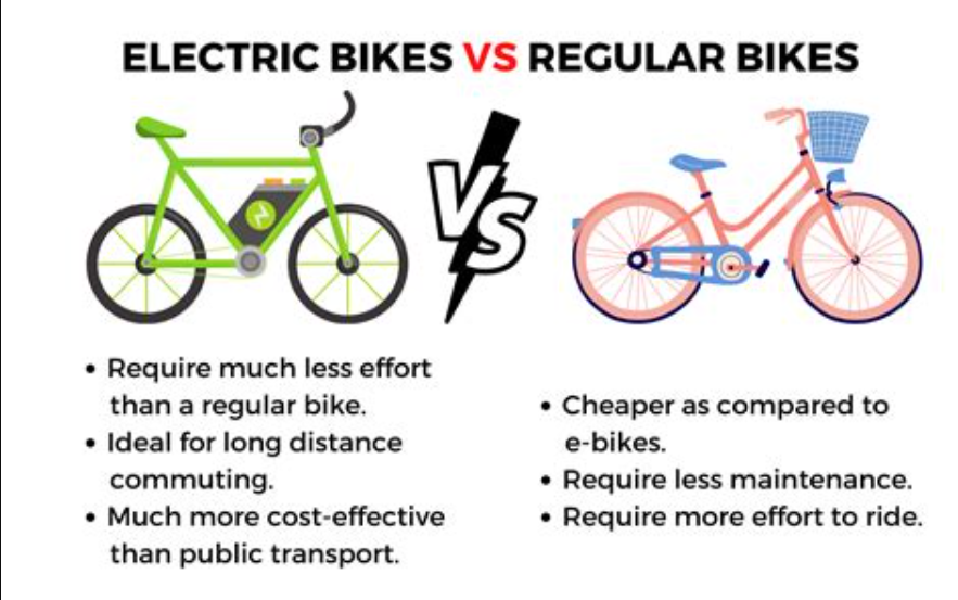
Since the trails opened I’ve been riding a lot more frequently. The up-tracks are brilliant. I’m old, not a very good rider and have a bottom of the line full suspension mountain bike (NO e-bike for me) and I can ride all the up-hill tracks easily. That, of course, has not stopped the influx of E-bikes or the punters asking when the shuttle bus will start operating. I don’t know if a shuttle is even planned, but, I do think people should toughen up and ride up-hill. Maybe you won’t do as many runs but maybe you also won’t end your days in a care facility with sarcopenia.  Easy choices in life are almost always poor choices in the long run.  


All E bike riders tell you that they only get a small boost from the electric motor. Conversely, every rider on a regular bike knows this to be nonsense. The E bike riders will even quote poorly done studies to support their viewpoint. But, the longer I live, the less faith I have in “science” which can be manipulated adroitly to support any position required. The science tells us men can be women and visa versa, but anyone who can tie their shoe laces knows that is hokum. The sooner we all start trusting what our eyes, ears and observations show, the saner our society will be. After all, the roots of science are in the observations of everyday people.


But back to E bikes. I met a bloke the other day who told me his E bike gave him 10% assistance which only proves the case in point. If you are really only getting 10% assistance from that heavy battery you carry around on every ride, you would ditch the entire thing and ride a regular bike.

Friday, September 13, 2024

Mount Carrialoo

Climbing mountains in Australia is not the same as climbing mountains in Canada. Below is a picture from a weekend camp in the Valhalla Range, not far from where we lived in Canada. There are nine mountains in the photo and we have climbed all of them; some as part of a traverse of four peaks in one day, some multiple times by multiple different routes (I’ve done three different routes up Gimli Peak) and we even did a first ascent of a new route on the furthest to the left (Mount Dag).


In contrast, the picture below is of Mount Moollattoo. It’s clear that climbing mountains in Australia, even if you go to Australia’s most rugged state, Tasmania, is just not the same. Before the dear reader even thinks of arguing the point, it’s been done, go here.


Different types of mountains, different experiences, but I still have this obsessive yen to get to the top of things no matter how insignificant. Mount Carrialoo is pretty insignificant really. The elevation gain is under 500 metres, and the top is scrub covered, but the cliff edge does offer lovely views of Morton National Park, and, it’s right there so why would you not go?


We did what most people seem to do, although possibly in a reverse direction, up one pass onto the plateau, along the top and back down a different pass using McPhails Fire Trail (FT) for access. The newest NSW topographic maps show McPhail’s FT only going to the border with Morton National Park but the FT actually continues north then turns east and climbs up another escarpment to meet the Promised Land FT. It is handy to have access to the old maps as some of these old FT’s are still passable. McPhails FT is in good shape for walking. Some satellite imagery (for example, the SIX maps version) clearly shows a foot-pad along the plateau of Mount Carrialoo although this foot-pad is hard to see on newer imagery on Google Earth. The foot-pad is there, but, as other parties before us have discovered only on the western part of Mount Carrialoo.


Right below the southeast corner of Mount Carrialoo, a cairn marks a vague foot-pad and pass up onto the plateau. This is right where McPhails FT first meets the base of the mountain. An old rope is tied to a piton (semi-secure) to assist with the only tricky step up. The foot-pad continues vaguely up but soon disappears completely at another cairn. We took the most obvious line towards the centre of the plateau figuring that this would intersect the foot-pad if indeed the foot-pad still existed. The going is mostly reasonable except for one saddle, only 10 metres lower than the surrounding terrain, but obviously wet enough to grow thick scrub. On the western side of this, we did find vague discontinuous foot-pads which eventually, about 250 metres from the trig, coalesced into a very defined and open foot-pad. From there, it was lovely walking to the trig and, continuing to follow the foot-pad north west to a view point over Morton National Park and Shoalhaven Gorge. Apparently, there is a pass below this spot and with a good deal of bush-whacking, it would be possible to get down to Yarrunga Creek.


After lunch on the cliff edge, we walked back to the trig and tried to follow the foot-pad back towards the eastern end of the plateau. We were a little more successful on the way east than west but the pad is discontinuous and the thick saddle needs to be crossed. We drifted our way up to the short cliffs on the north east side of Mount Carrialoo and easily scrambled down through the 15r escarpment, and, drifting further north to the escarpment edge, steeply down through mostly open forest to intersect McPhails FT. From there, it is a pleasant, easy and quick walk back to the trail head.

Thursday, September 12, 2024

How Not To Multi-Pitch Climb

My old friend, Hamish, frequently opined that two pitches is not multi-pitch climbing. Three pitches, presumably is, but what if all five pitches are really short, and altogether only total the length of a two pitch Red Rock route? The answer, like life, becomes less clear. What is clear is that we were not equipped for multi-pitch climbing because we did not intend to multi-pitch climb.


Hamish on lead at Smith Rocks,
From the H. Mutch collection


Doug and I had driven up from the coast to climb at Mount Alexandra, and, the night before leaving I had checked Mount Alexandra Reserve on the web to make sure there were no closures. Australia, if you live under a rock and are not aware, is the world’s largest Nanny Country and closures of trails and natural areas occur with increasing regularity as access is perceived by our risk averse overlords to be “dangerous” due to a variety of increasingly infinitesimally inconsequential risks. Pubs, cafes, junk food shops, gambling dens and brothels never close. But natural areas do. Timid populations are easily controlled.


High up on Jonny Vegas at Red Rocks


With that foreshadowing, it’s not hard to guess that Mount Alexandra Reserve was closed. My nephew, Mitchell, was driving down from Sydney to climb with us and had already left home so we needed a back-up plan and quickly. Luckily, there are two main climbing areas close to Mittagong, the second being Mount Gibraltar. We have climbed at Mount Gibraltar before but not for about seven years, hence our recollection of access and routes was lost in the back of our brains and not readily accessible. We were however, able to download the Crag guide, although reading these guides on mobile phones is difficult as the images are small and the text becomes a bit garbled rendering finding your way around the routes a bit trickier than using a standard paper guidebook.


Mitchell carrying two packs on Mount Gibraltar,
PC: DB


Deciding on Slab Walls, we set about sorting gear to enable three people to climb multi-pitch routes. Mitchell does not climb frequently so had nothing on his harness at all, partly my fault as I had neglected to tell him to bring a belay device or PAS. If you climb regularly these pieces of equipment reside on your harness and you forget that gym climbers do not follow this practice. Essentially, we took everything we had with us that vaguely resembled climbing equipment: one rope, a clutch of quickdraws, two 30 cm draws each equipped with one standard carabiner and one screwgate carabiner (as the Aussies call them) which we use for top anchors on single pitch routes, two BD ATC-Guides, two PAS, and between us three short lengths of cord usable as safety backups for abseiling.


Belaying two seconds at Castle Rocks in Idaho


What we would have taken had we been appropriately prepared would have been two half-ropes instead of one single rope, two cordellettes and some extra ‘biners so that two stations could be equipped at the same time. Of course, it is possible to use the rope for this instead of cordellettes and rock climbers who argue on the internet quadruple the time they actually spend rock climbing frequently site the practice of using cordellettes to equip all intermediary belays as silly when a rope can be used. But, realistically, having two anchor set ups on multi-pitch routes results in more efficiency in the long run. Likewise, two half ropes enables – with an appropriate belay device such as the ATC-Guide – the leader to belay two seconds at the same time. On meandering routes, such as the ones we climbed, two ropes also reduces rope drag, and allows the leader to combine pitches.


A nicely organised belay on Mount Asgard,
Valhalla Range

With only one rope, we had to tie Mitchell into the middle using an alpine butterfly, while I climbed on the very end. This meant we climbed singly instead of both climbing at the same time. It also meant that on routes with very short pitches that wandered a bit, or pitches that were over 30 metres long it was difficult or impossible to link pitches. But, it worked, and no significant safety issues were encountered. Which is why, at the end of the day, it is necessary to work with principles not rules, because sometimes you get caught out without the perfect set-up but you still need to make the day work.