Sunday, February 23, 2020

Pent Up Demand: Moruya to Ulladulla By Sea Kayak


Pent up demand is a term originally coined by economists to describe a rapid increase in spending for some good or service after a period of depressed spending. But those of us more at home in the backcountry than the mall know pent up demand as the gung-ho fever that causes an up-tick in avalanche involvements as backcountry travellers pour out into the mountains when the sun finally comes out after the mother of all winter storms.

Skiing in conditions that lead to pent up demand

Down here on the South Coast of NSW, Doug and I were certainly feeling the pent-up demand for a few days kayaking and camping along the coast. A summer of fires and closures had meant that no-one ventured far from home, never knowing if we would have a home when we came back. Finally it rained, not near enough to break the drought, but enough that the last of the local fires were considered contained and we started thinking about paddling again.
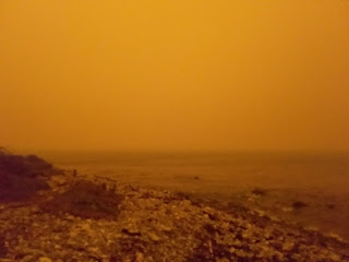
New Years Eve 2019

No-one felt very fit. In five months, I had only paddled a dozen times and some of those paddles were pretty short, but Doug and I had pulled off a 40 kilometre day on Christmas Day with no special training so paddling from Moruya to Ulladulla, a distance of roughly 100 kilometres seemed feasible. The forecast was for light southerly winds with a long period and a big swell. It would be a trip to learn well the lesson of the bombora.


Doug arranged some reasonably elaborate car shuttle arrangements. I am not good at organising car shuttles. I seem to have some spatial black spot in my brain that makes juggling around which car is where and with how many boats near impossible. Most of the time I would much rather use public transit to return to my car after a one way trip but public transit between Ulladulla and Moruya involves at least two bus transfers and the critical bus leaving Ulladulla does so only once per day. So, car shuttle it was.

Launching in the Moruya River

We launched into the Moruya River about a kilometre from the breakwater. A headland protects the river mouth to the south and a breakwater to the north. The channel runs swiftly with the deepest water along side the breakwater. There are always breaking waves to the south of the channel and on big days the entire entrance to the river closes out. We had an outgoing tide which helped with paddling out but conversely tends to make the waves stand up. People crash and burn, with sometimes disastrous results in these river bars all the time. 

Doug in the surf at Moruya River mouth

I admit to feeling some trepidation as we approached the river mouth but maybe that is reasonable given the three metre swell and how close to the breaking waves we were. However, paddling out turned out to be quite straight forward and we were soon heading north towards Burrewarra Point. The first time Doug and I paddled around Burrewarra Point we were so traumatised by the experience that we opted to take the bus back to retrieve our car rather than return around the Point by kayak.

Burrewarra Point on a previous trip

A few years on and I am used to paddling around the bumpy water off Burrewarra Point so was not so white-knuckled this time. We paddled into Guerilla Bay for a lunch break tucking into the most protected beach behind the rock reef that is an island at high tide.


Paddling past Bengello Beach

After lunch we headed north in no particular hurry to get to camp but not dallying either. The swell had really picked up in both size and power with the bigger sets coming in close to five metres and a 10 to 12 second period. Passing Mosquito Bay there were masses of breaking waves and I was not sure we were not going to have to detour out to near the Tollgate Islands to avoid reefs and bomboras but we found a way through.

Views near camp

We found a fabulous camp site with nice grassy level sites and tremendous views but landing required some caution as the swell was picking up and the beach steep. The soft grassy site was particularly appreciated by Doug and I as I had forgotten to pack our sleeping mats.

Finding unburnt forest

The swell dropped briefly by half a metre the next day before picking up again and still the long period with some very energetic waves powering in. We had a nice paddle north to Depot Beach and a sheltered landing for lunch. Rae and Doug paddled to the west of Grasshopper Island while Mike and I went around the east side. Both options had their moments. For Doug and Rae, a wave closed out the passage behind them, while Mike and I paddled through an entertaining tidal race off the north side of Grasshopper Island. There is always a bit of an epic near Grasshopper Island as you can read about here.

Doug following Rae through the west side of Grasshopper Island
PC, DB. 

Continuing north, Doug and Rae had another narrow escape at Clear Point paddling a gap in the long reef. I was about to follow them through when a big set powered across and I turned tail and followed Mike who had sensibly paddled around the most easterly reef.

Point Upright

About four kilometres from Kioloa, the only place we knew we could land with certainty in these conditions, Rae began to vomit. Vomiting is unpleasant at the best of times but is doubly troubling in a small sea kayak adrift in a big swell with bumpy seas. Rae, however, is a strong and determined paddler so we continued paddling, sticking close together to keep an eye on her. Last time I was out with a vomiting paddler, the whole trip turned from gloriously fun to dangerously epic very quickly.

Sick paddler under tow

Unfortunately, the four kilometres to Kioloa was slow paddling in rough conditions and there was a huge break off O'Hara Head that we had to give wide berth to. Rae was still vomiting as we paddled into more sheltered waters.

Near Kioloa on a calmer day

Rae pulled out at Kioloa, leaving three of us to continue on. In search of a more remote campsite, we paddled four kilometres north looking for a sheltered landing and finding only crashing waves and frightening conditions. The swell was so big that the waves were breaking all over the place and even seeing the beach without getting creamed by a big set was difficult. It was late in the day and we were all getting fatigued, too weary to deal with desperate landings or even more desperate rescues so we returned to a safe landing site and found a pretty good campsite tucked into a banksia grove.

Camping along the Murramurang Coast

During the night I heard Mike screaming himself awake from some unknown nightmare and I wondered if he was dreaming of trying to land on a south facing beach in a five metre southerly swell. Over night the drizzle turned to light rain and it was a gloomy morning putting on wet paddling clothes and stowing away all our now wet and grimy gear.


Doug playing beach master on a previous trip

Some tourists came down to watch us launch, which we luckily all managed with aplomb. It's always embarrassing to crash on the beach with an audience. Over the course of the day the swell lost some of its fury and size. We managed to paddle to the west of Brush Island, an impossibility the day before, and found much calmer seas on the north side. Landing at Crampton Island for lunch required a bit of careful navigating to avoid a breaking reef but was well worth the leg stretch.


Landing at Crampton Island on a previous trip

The final 14 kilometres to Ulladulla Harbour felt surprisingly easy given we were up around 100 kilometres of paddling in three days and it was not even too rough around Warden Head. Neil and Rae obliged with the final leg of the car shuttle by picking us up and taking Mike, Doug and I south to Moruya.

Near Warden Head on a previous trip

Most of these photos are from previous trips as I ended up with a serious dearth of decent photos from this trip.  

Saturday, February 8, 2020

Sunday Runday Every Day Is Runday


I've been exploring the neighbourhood. The Currowan mega fire burnt 90% of our forests and national parks, and even before everything burnt, the forests were closed to prevent new fires. Now there is nothing left to burn, the forests are closed because everything burnt. I get cranky and depressed if I can't get out into nature so I've been exploring from my house, running through little reserves, along creeks, through remnant bits of forest, along cliff tops and beaches, joining up all the little bits of nature into long morning runs.

Little wooden bridges in the woods

This is best done on foot. Whizzing by in a car, or even on a bicycle, is not conducive to ducking into patches of woods, following little footpads used by people and animals, or scrambling over rocks. Each time I go out, I find something new. A little bridge over a side stream, a waterhole freshly filled with rain water, starkly burnt trees against the skyline, or hidden trails flowing through patches of forest.

Gum trees against a stormy sky

Five great things about today:
  • Finding little bridges across streams just where you need them.
  • Surprise trails in the forest.
  • Trees against a dark sky.
  • Rain.
  • Meeting Sunday runners on the trails.
High tide and a big swell

Friday, February 7, 2020

Reprieve and Rain


The Currowan fire is under control; 2.5 months after spawning several other fires, becoming a mega fire, and burning 90% of the forests and National Parks in Eurobodalla, the Rural Fire Service has declared the Currowan fire under control. And, rain is forecast, although to date, there has not been near as much as any of us hoped for, under 30 mm at our place, but more may be coming.

High tide, empty beach, rain at sea

The respite from water bombers, smoke and sirens is welcome, but more welcome is the idea that with rain the forest can begin to heal. This year, however, the fires have been so extensive, burning almost all the forest along the eastern coast of southern Australia, that much native flora and fauna will not recover. Populations of animals are too scattered, there is too little food, too little habitat remaining and too many introduced predators. This may see the extinction of many native species from Australia.

Rivulets 

But, there are bright spots today: water running where it has not run for a long time, tiny little wrens in the undergrowth in unburnt forest, morning runs when the beach is deserted, little forest paths over streams through neighbourhoods, and yellow tailed black cockatoos in the trees.


Wednesday, February 5, 2020

Tenacity


This guy showed up a couple of weeks ago and we are slowly becoming friends. I put seed in a small container for him/her (I have no idea how to determine the gender of sulfur crested cockatoos) and put it out on the grass when he comes around in the evening.

I call him "Tenacity" and every evening when I see him my spirits lift. It's clear he has not had an easy life, but he shows up everyday and gets on with things. There is a powerful lesson there for all us.


Sunday, February 2, 2020

Rain, Flowers and Bye Bye Bridget


Last night there was a steady trickling sound, no, not the sound of a broken pipe, but rain, gently running off the roof into the rain tank. Only 4 mm, so not nearly enough to break this terrible drought, but, it is perhaps a start. I was early enough to the beach to watch a fruit bat fly off into denser forest, the sunrise was beautiful, and unusually not smoky, and I found a big patch of bright yellow flowers alongside my grassy route home.


Today's gratitude:

  • Rain is forecast for later in the week.  Lots of wonderful, life giving rain.
  • Sunrise on a quiet beach.
  • Surprise yellow flowers.
  • Bats in trees. 
  • Goodbye Bridget 

Tuesday, January 28, 2020

Okanagan Mountain Thrashing


I am still catching up on blog posts from our trip to Canada in 2019. Those adventures all seem so long ago, especially after the 2019/2020 Australia fire season, that I have to go back to our trip database to help me remember the details of our mountain adventures. As an aside, if you don't have a trip database, however can you relive "this day in history?"

A picture from "this day in history" 2005

Anyway, I was going to rewrite my trip report for this rather epic journey around Okanagan Mountain Park, but, after re-reading my report in our trip database, I am simply going to copy it in here. It gives a pretty reasonable idea of what this trip was like. First, however, a few introductory comments.

Okanagan Mountain Park, have a gander at the map below, lies on the east side of Okanagan Lake at the south end of the rapidly expanding city of Kelowna. It gets hot in the summer, Australian hot at times, which Canadians like and is managed by BC (British Columbia) Parks, a chronically underfunded and under-resourced provincial agency. In 2003, a huge bushfire, started by lightening (as are most Australian bushfires despite what the Murdoch media propagates) burnt the entire park and 240 homes.

My route: CN, Divide Lake, OK Mountain, Baker Lake, Wildhorse Canyon

Courtesy of my friends who live in Kelowna and with whom we were staying, I had a laminated paper map of the Park, much like the one shown below, and, a little bit of study convinced me that a great rest day activity (we had been rock climbing in nearby Skaha Provincial Park) would be to walk a huge loop covering almost all the tracks in the park. I would start in the north, walk south along trails on the east side of the Park to the south end, then walk west, then back north again. I was undeterred by the story my friends told of having to sleep overnight on the track because they did not make it to the campground at Divide Lake. The fact that this outing was around 35 kilometres long with over 2000 metres of elevation gain, and it was forecast to be a hot day, also did little to dampen my enthusiasm.

Doug on one of Skaha's beautifully clean climbs

The final thing I will mention is that the tracks, with the exception of the Divide Lake trail, which goes to a very popular backcountry campsite, have never been properly maintained since the 2003 fire. As such, there is a lot of dense undergrowth, a lack of footpad, virtually no trail markers, or trail markers on toppled over trees, braided tracks, and disappearing tracks. Suffice to say that it is not a fast track.

I left the Topor house around 7 am and started walking about 7.30 am. Most of the trails are not really that good. The OK Mountain fire burnt all the trees and toppled many of the marker trees, and some of the vegetation is growing back quite thick. Additionally, apart from the track to Divide Lake, the trails are not heaviy used enough to keep them clear. BC Parks, as usual, has done little trailwork.

Okanagan Mountain

All junctions are signed and most have a map of the track and the distance to the next intersection but some junctions are just marked with signs, and there are some spots where there are multiple trails. In places, the trails are a bit vague and hard to follow, while in other places there is a lot of greenery to push through, and, in yet, other spots, the track is stony and eroded.

I took the Boulder Trail up to the CN Trail which loses elevation for a distance then crosses a creek on a bridge, heads uphill a bit and then splits with the right hand fork heading west and the left hand fork joining with the Divide Trail which is an old road. I was a bit surprised at how long it took me to get to the split and this would become a theme for the day. Once on the old road, travel was easy and it is scenic and pretty with folded cliffs and gullies and masses and masses of wildflowers.

Wildflowers beside the trail

I passed one young woman on the way to Divide Lake and arrived at the campsite after 3 hours. Of course I was feeling really fresh here so decided to continue on with my planned loop. There are picnic tables and a hut at Divide Lake and a neantheral couple were hacking at dead trees to keep their campfire going. I texted Doug and continued on.

Still old road to Okanagan Mountain which does not have much of a different view to anywhere else. I did not stay but walked back down the road and located the sketchy track signed for Baker Lake. Immediately, I thought, this will be a slow track, and it was. I had to watch for a foot pad and markers as where it had been burnt was hard to see. The trail markers are on trees that have fallen down onto the ground.

Baker Lake

I had a nice view of Baker Lake which would be a way better place to camp as I suspect not many people go. Beyond Baker Lake I had a couple of spots where I lost the track for a bit or took the wrong fork and it was slow going. This is the Frederic Creek Track. I passed two guys resting here but no-one else until I was back on the Boulder Track at the end of the day.

Coming down I took a fork to the right, but it was wrong and I had to get a GPS signal, then bushwack back east to regain the track. I lost at least 40 minutes here as I was struggling to work out from the map on the phone whether the track junction was to the east or west of me. Unfortunately, the first time I got back on the trail, I turned around about 40 seconds from the track junction which is quite near Frederic Creek. Eventually, I walked back towards Frederic Creek where I found an unsigned junction that matched the map - once I looked closer at the paper map, and I turned right and after a bit came to the actual signed junction.

Not much forest regrowth after 16 years

I was getting a bit concerned about time but not too worried and walked on to have a quick break on a rock slab and text Doug. I thought I was about half way to Goode's Creek but I was nowhere near that far along. I walked and walked and walked along a track that wound up and down, often through brushy undergrowth and finally got to the Goode's Creek junction. This was definitely a bit confronting as I now had 17.5 km (according to the sign) to reach the north parking lot. I thought I was probably only traveling at about 2 km an hour, so I would be getting out around about 11.30 pm! Yikes.

The next junction was 2 km away and I timed that section plus tried my best to walk faster. A lot of uphill again and dense shrubbery in places. I timed myself at 2 km in 45 minutes - not great. Now I had 15.5 km to go. I tried to call Doug but had no reception so kept walking.

Looking down towards Wildhorse Canyon

The next section would have been nice if the bush along the bottom was less thick and there were not mosquitoes. The track, however, was easier as it ran in a straight line up the middle of a small canyon with little cliffs on either side. Quite pretty. But, each side of the track was pools of standing water and the mosquitoes were insane. I was walking as fast as I could and swatting mosquitoes with my hat. I got dozens and dozens of bites and was going a little bit spare. A bit of self talk was needed that these were only mosquitoes and I was not going to die.

I managed to leave Doug a message that indicated I was in survival mode and could he call me back. I was still concerned about darkness falling and trying to walk out in the dark - with no headlamp! Doug called me back near when I was reaching the end of the mosquitoe tunnel and I told him I would keep going and let him know when I got to the next junction which was my only way of knowing how far I had to go.

Trail through Wildhorse Canyon

Eventually, I got out of the mosquito tunnel and the track turned into a bit of an old road so it was easier going. I had not had a drink for hours but wanted to get some idea of how far I had to go before I stopped to eat or drink. Finally, I got to the Goode''s Basin junction which is not how it looks on the map as the old road continues down to the lake, and the track turns into a scrappy track again and begins climbing, climbing, climbing. I drank 750 ml of water and ate an energy bar while I walked and told Doug where I was but I did not know how far I had to go as this junction had no distance recorded.

View from OK Mountain down to OK Lake

Finally, I came to a junction near a creek which indicated I had 5 km to go. I knew this would be a hard 5 km and would climb back up again, which it did. So, lots more up, a narrow somewhat scrappy track and my feet were now so sore it was painful to walk. Finally, after a shattering descent on slippery, steep, rocky ground I reached the last junction which I had passed 12 hours ago. The track, of course, goes uphill until the final shattering descent. I staggered out to the car after 12 hours and 15 minutes, nearly crippled with sore feet.

I passed two young women on the track who got a shock at seeing a near delirious older woman staggering along. The last few hours of the walk I had felt quite spacy and strangely lonely.

Wildflowers growing in dusty ground

Monday, January 20, 2020

Zupjok, LLama and Alpaca Peaks: Coquihalla


The logical thing the day after scrambling up Needle Peak was, of course, to follow a scrappy track up Zupjok Peak and ramble along alpine ridges over Llama Peak and up Alpaca Peak. The little forested peak between Zupjok and the highway is called Ottomite and apparently has reasonable skiing in winter, but unless you are a really obsessed peak bagger - which I am not, any more - it's not really worth the detour to tag the summit.

Looking along the ridge to Llama and Alpaca Peaks

There is an old road that leaves the road side rest area, crosses a creek (new bridge) and approaches Ottomite Mountain, and, if you follow this road, you will find a faint trail that runs up the south ridge of Zupjok Peak. There is sporadic flagging and an equally spotty foot pad, but the trail certainly helps get through low bushy undergrowth to the alpine.

Doug at the base of Alpaca Peak

The first peak encountered is Zupjok Peak and from the summit it is obvious that the route to Alpaca Peak is a very pleasant ridge ramble above forested valleys on a mix of meadow, granite slabs, and early season snow.

The spectacular Steinbok Group

Accordingly, we wandered down the north ridge of Zupjok Peak and up the south ridge of Llama Peak. On Llama Peak there is a great view of the spectacular Steinbok Group. It is less than two kilometres along the ridge to the summit of Alpaca Peak where we stopped for lunch. Lots of big granite boulders around the summit and we found ourselves a spot sheltered from the wind and enjoyed the view of Vicuna and Guanaco Peaks to the east. After lunch we wandered back.


Vicuna Peak from Alpaca Peak