It is not exactly clear to me why I wanted to walk up Mount Donovan in Deua National Park. At just over 900 metres, it is not the highest peak in the park, fire roads go to higher mountains; but it is difficult to reach, particularly if you come from the east, and marks the northern extent of the Donovan fault line, a plug of old volcanic rock which has eroded into relatively sharp ridge-lines and deep cut gorges.
Away from the ubiquitous fire trails, most of Deua National Park is infrequently visited. The valleys are deep and steep sided, any trip off fire trails requires committed bushwacking, the ridge lines are waterless, while the creeks and rivers can be choked with vegetation that makes travel slow and difficult. Since the 2019/2020 fires, even the old bridle trails have disappeared under thick regrowth. Of course, in some weird way, all of that adds to the appeal as I am one of those increasingly rare people who simply enjoys the challenge. The problem with a comfortable life is that it becomes harder and harder to face physical and mental challenges. Eventually, we lose the will altogether.

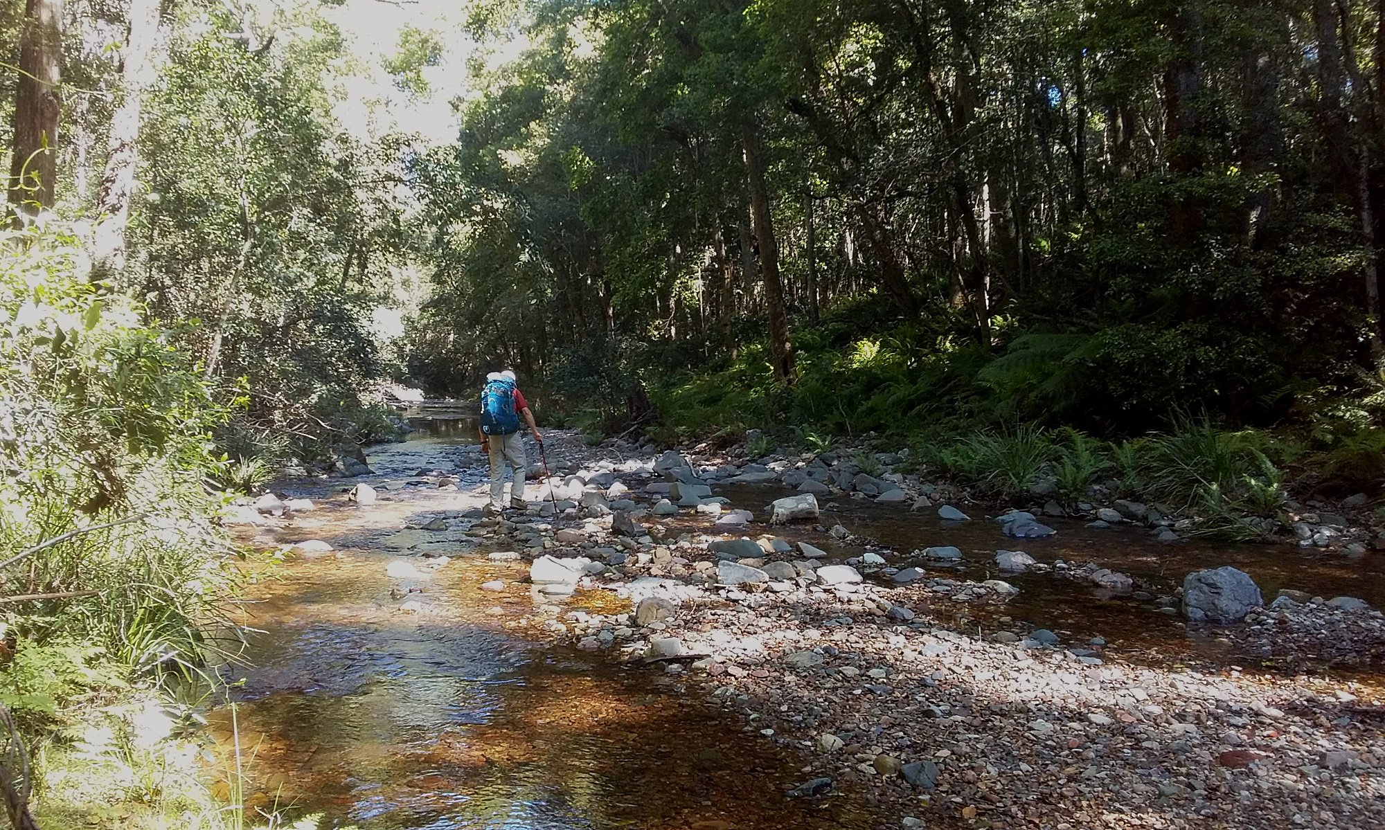
Approaching from the east, there are three different, almost equally long, ridgelines that provide access to Mount Donovan; all originate at Oulla Creek so the first thing a walker has to do is access Oulla Creek. Fire trails run along the long north south running ridgeline to the east and provide a bushwack free approach to within a kilometre or so of Oulla Creek.

Leaving around noon, we had a couple of hours fire trail walking before dropping steeply into Oulla Creek where we found a wonderful camp-site in preserved rain-forest beside pools and small falls on Oulla Creek. After the obligatory mug of tea, I scrambled above Oulla Creek and down an old blind channel to rejoin Oulla Creek and the base of the ridge we would walk up next day. A mini reconnoitre to confirm our plan was not completely crazy.
I got up at first light the next morning and put the stove on for coffee. Doug followed shortly after and we had coffee and a quick breakfast and were away from camp at 7.15 am. We quickly crossed the ridge and descended back down to Oulla Creek and jumped across to the other side at a narrow gravel bar and started walking up.

We had a 400 metre climb up a spur ridge to join a prominent and narrow in parts ridge that runs along the south side of a deeply incised gully. The bush-wacking varied from quite easy to moderately difficult in sections where the ground was steep and loose, and the regrowth tangled in with burnt and fallen trees. At around 480 metres ASL (above sea level) we clambered up onto a narrow ridge of broken rock quite characteristic of the Donovan fault line. To the north was a deep rugged gully lined with bits of cliffs, also remnants of the Donovan fault line. To the east, we had views over the lowlands to the coast, while south lies the larger bulk of Deua National Park.

The next 1.5 kilometres of ridge was slow going although we gained very little elevation. Scrambling along the spine of the ridge was fun and almost reminiscent of mountaineering trips in Canada, except that there were twisted and twined trees and shrubs to push through. The views were spectacular, except that the top of Mount Donovan still appeared a disconcerting distance away.

After about two hours uphill, we scrambled off the narrow ridge and down to a saddle where we had a further 400 metres of uphill bushwacking to reach the top. There was definitely some very thick and slow travel through this section as last summers overgrowth of annuals had died back and lay thickly over the top of ankle twisting talus. Each step required a large high step to push down the dead vegetation matter and often it felt like we barely touched actual ground walking instead on matted dead vegetation. Finally, however, we intersected a north south running ridge and walked up open ground under large eucalypts to the trig at 906 metres. All around the ground falls away steeply and the top feels like an airy place to visit. A short distance down from the top we scrambled onto a big boulder with a view to the northwest for our first break of the day.

It was, however, a necessarily short break as we still had a long way to travel. As one always does after a long ascent, we looked for a "short cut" back to Oulla Creek, but, as is so often the case in the wilderness and life, there was no short cut, so getting back to camp involved retracing the route. Surprisingly, we did manage to shave about 40 minutes off our ascent time; often when bushwacking going down can be as slow as walking up. At 2:30 pm, we crossed Oulla Creek to our campsite, blackened by charcoal, scratched and torn, but pretty happy. I plunged into the chill Oulla Creek to wash off six hours of sweat and grime before pulling camp down while Doug brewed up a much deserved cup of tea.

We had a full hour at camp, although with taking down camp and packing backpacks, the actual rest time was considerably less. The least appealing part of the return trip was a 300 metre bushwack up through thick and tangled vegetation to regain the fire road. Doug thought this would take 1.5 hours given we were now hefting heavier packs and were somewhat fatigued already, plus, this last section of bush-wacking was some of the most tangled and tedious we did over the entire trip. However, one hour after leaving camp I regained the fire trail at exactly the spot we had left it a day and a half ago, despite having sweated profusely on the way up as the weather changed and the humidity increased. A couple of hours fire trail walking, one more river ford, and we were back at the car, tired, grubby, happy.
No comments:
Post a Comment