Showing posts sorted by relevance for query just a bit worse. Sort by date Show all posts

Friday, March 21, 2014

Not Much Worse Than The One You Had Before: Cambie Creek to Skaist River On Skis

You guessed it, more rain in Cairns, so time for another stroll down the pathway of my memories.  Looking for inspiration, I clicked open our trip database (having a programmer for a partner can be pretty handy) and used the handy "this day in history" feature - a tribute to our good friend now sadly missed, Kim Kratky -  to find this old trip report from 2009. 
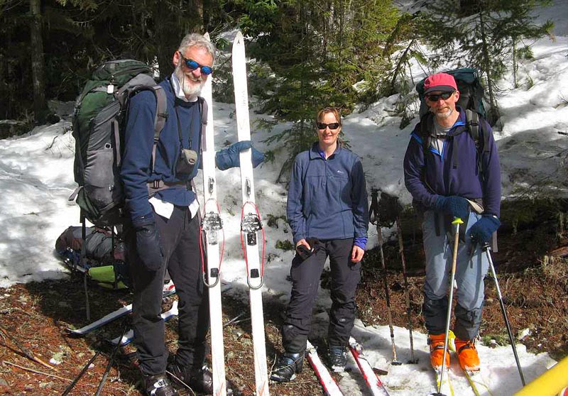
Robin, Betsy and Doug at the end of our trip

Prologue: In late February/early March, we’d kicked around a few ideas for a short ski traverse for mid-March with Captain Bivouac and Betsy Waddington, but, we seemed unable to settle on a destination we could all agree upon. Captain Bivouac, romantic as always when it comes to the Rockies, was convinced that a great Rockies traverse travelling many kilometers each day up untrodden valleys to lost passes on long skinny skis with leather boots and cable bindings would be the best trip imaginable; but Doug and I, altogether more realistic about conditions vetoed this plan as we knew from friends in the Rubblies, that this years’ (2009) snowpack was significantly worse than last years, and, in most places was failing to support even a light weight skier. 

Eventually, the idea of a trip through Manning Park surfaced, and two days later, Doug and I were driving west to meet Robin and Betsy at Cambie Creek packed for a 5 to 6 day trip with a rough itinerary we could shift around to suit conditions. 

 Three Brothers Mountain from the south

Day 1, Cambie Creek to Big Buck Mountain: The first day out with a big pack is always a bit of a grunt, and it seemed a bit of a trudge up Cambie Creek and Fat Dog trail to the sub-alpine area around Big Buck Mountain. Of course, the trail was just a bit worse than previous as immediately before we left, a group of six snowshoers and one postholer had marched off up the trail ahead of us, stomping the ski track into a rutted mess. 

Once we got to the subalpine ridges near Big Buck Mountain, we finally passed the snowshoers, and emerged into the full brunt of a strong SW wind. Wandering up towards Big Buck we had lots of whumpfs and there were numerous recent slab avalanches, evidence that the snowpack was just a bit worse than before. We ended up setting up camp early in a sheltered area about a kilometre from Big Buck Mountain as we weren’t sure where the next protected area would be. Unfortunately, a gang of five sled hooligans were roaring around the sub-alpine, well inside the park boundary on their sleds. At one point they drove right past our camp and all the way over to the Heather Trail. For all we know, they sledded right down to the Ranger Station.

 Big Buck Mountain

It was at this point that Doug and I discovered that I had forgotten to pack the pole for our tent vestibule and had brought half the amount of white gas I should have. I left Doug trying to jury rig the vestibule and skied the kilometre or so to the top of Big Buck Mountain where the wind was almost strong enough to blow me to Princeton. 

Day 2, Big Buck Mountain to Nicomen Ridge:  Our makeshift vestibule using two ski poles actually worked better during the night than the proper version with the aluminium tent pole, but when we tried to pack the tent in the morning it was like trying to wrestle with a hungry alligator. This is our second single wall Integral Designs tent – the first, lasted 15 years, never leaked, got wet with condensation or threatened to collapse in a storm. But, the newer version – advertised as “breathable”, breathes about as well as a fish out of water, and, despite sleeping with the door open all night, the walls were caked in frozen condensation, thick enough to generate a Rockies ice climb in good plastic conditions. 

While we bemoaned our misfortune to have purchased such a dud, Robin related his recent shopping expedition to MEC looking for a replacement summer tent. It seemed he had inadvertently sent the salesperson into an apoplectic fit when he described his ideal tent as one “tall enough so I can sit up in one end while Betsy cooks in the other”. This sent the salesperson into paroxysms of proclamations of certain death due to grizzly bear attack. Once the salesperson had recovered the power of coherent speech, it became evident that MEC had a good selection of tents, but none quite as good as the one Robin was trying to replace. 

 Betsy skiing up Fourth Brother Mountain

The wind was somewhat less than the day before, and it was snowing only very lightly as we skied past Three Brothers Mountain on the southwest side, through a narrow pass and on through gentle sub-alpine terrain to the west side of Fourth Brother Mountain. Here we dropped our packs and skinned a short distance up to the top of Fourth Brother Mountain, where, true to stereotypes we found the small area just below the summit littered with beer cans dropped by the sledheads. 

We had lunch back at our packs, and then carried on skiing generally northwest staying right on the ridge top where the terrain is broad and easy all the way to Nicomen Ridge. We followed Nicomen Ridge east for about 300 metres until a spur ridge runs north. This was the crux of this very easy ski trip, a short section where you must stay right on the ridge to avoid avalanche exposure. We skied easily down the north spur ridge and found a sheltered area to camp just before the ridge begins to climb gently to the north again. 

 Betsy above Nicomen Lake

Day 3, Nicomen Ridge to Hope Pass:  It was snowing again in the morning and the weather was just a bit worse than it had been the day before. We were lucky this section of the trip was in the trees as any time we came into a larger opening we would feel the brunt of the wind driving the snow along. From our campsite we climbed gently to the summit of a north south running treed ridge, then descended about 140 metres down to a pass, before climbing again, this time heading northeast to reach a broad flat ridge system that led us east to another large flat summit.

Lunch was a cold affair, spent huddled under some trees while the snow fell and the wind blew. After lunch, we continued north passing by some small tarns, and then eventually descending to Hope Pass, a narrow cleft between two treed ridge lines. At Hope Pass, it was snowing heavily and blowing, so we followed a compass bearing west to a small tarn that offered sheltered camping in the trees. 

 Our tent now free standing

Day 4 Hope Pass to Grainger Creek:  By now, Doug and I were thoroughly wet inside our “waterproof, breathable tent” and approached our third night in this frigid version of a sauna with some trepidation. I slept in every piece of clothing I’d brought with me, including a down jacket, and managed to stay warm, but woke with the ice on the walls a full centimeter thick by now. 

There was a fresh 20 cm of snow on the tents in the morning, but luckily it felt pretty light. Although it was still snowing, we headed off to ski to the top of Skaist Mountain, following the inevitable compass bearing to the northeast. The top is fairly open, and might have had decent views but all we saw was snow and a hint of a ridge line in the distance. 

Back at camp we wrestled the tent away and headed off skiing slightly downhill and heading west. The trees were tight and some of the terrain a bit tricky to ski through. However, the fresh snow made the descent a fair bit more pleasant than skiing on breakable suncrust. Robin was having a terrible time with his gaitors, which, for some inexplicable reason had been made with Velcro closures – who exactly thinks Velcro will work in snow? – and they kept popping open and forming the shape of a inverted snowplow which funneled large quantities of snow into his boots at every turn. Clearly, these gaitors were much worse than the pair he had before. 

 Easy skiing along the route

After we’d been descending and traversing for perhaps an hour, Doug stumbled onto the Hope Pass trail and for a while, we cruised downhill following it through switchbacks and down near to the Skaist River. Near the river, we lost the trail and also lost quite a bit of time trying to find it again. Eventually we did, and skied on for perhaps half a kilometre before repeating the whole process again. After doing this about three times, we decided to just head in the direction we knew the trail was going and hope to pick it up. After this, we never lost it for more than a few hundred metres, and always found ourselves back on it again in short order. 

The lower we got the heavier the trailbreaking got, and occasionally, the snow would stop falling and the sun would pop out. In these brief interludes the snow quickly became wet, sticky and heavy. We plugged away reaching a bridge across the Skaist River around 3 pm where we stopped during a brief sunny spell for a snack. 

 Robin tunneling into a snowbank

Once across the bridge we lost the trail and wandered a bit on a small island in the river, which we eventually had to get off. I stood midway and watched Betsy doing some creek skiing to exit on my right and Robin doing some snow- tunneling to exit on my left. Unexpectedly, given the hilarity which watching Robin had provided, his exit seemed easiest and I cruised up that way. Continuing downstream we hit an impassable canyon and had to skin up a steep side-hill perhaps 80 metres or so where we suddenly came upon the trail again.  It was near 5 pm by the time we reached Grainger Creek camp and we were all feeling tired. Our tent now had a glaciers’ worth of ice on the walls and we were actually able to erect it without using the poles at all. 

Day 5, Grainger Creek to Cayuse Flats:  Next morning we got away before 9 am but spent the first 20 minutes searching for the trail on the south side of Grainger Creek. Eventually, Betsy found it and we started the day by skiing uphill for 15 minutes on a trail that was supposed to be following the creek down. 

Doug enjoying the skiing

The trail certainly provided some entertaining skiing – the very occasional wide downhill section interspersed with a mixture of narrow, lumpy trail with numerous running cross creeks, severe uphill sections, downed trees that required clambering over, half-downed trees best passed by doing the limbo with a full pack, and various other impediments to smooth travel. After the initial 15 minute climb, we managed most of the way without skins, but, right at the end, the trail headed straight uphill again, and all of us but Robin, put our skins back on and somehow finished the trip going uphill again. 

Epilogue:  The moral of life, as we saw it on this trip, is that every piece of outdoor gear you get will be almost as good as the piece it is replacing. Think about it – you are probably, like us, using pots that your grandfather made in shop class and are now 50 years old because the new ones burn instantly, your latest tent leaks just a bit more than the last one, your gaitors won’t stay on/closed/fit over your plastic ski boots, the pump for your new stove broke within the first six months of use, and the replacement pump- which cost half as much as the stove - requires a whole shop of tools to get it apart to lubricate the flange, your skins don’t stick as well as they did, or that goofy G3 tail attachment always blows off the end of your ski, and so it goes. The best you can hope for, is to end up just a little bit worse off than when you 
started. 

 Three Brothers Mountain

Tuesday, November 28, 2023

The Story of Erowal Bay: Part One

Booderee National Park is a big peninsular bounded on the north by Governor Head (and off-shore Bowen Island) and on the south by St Georges Head and features about 13 kilometres of steep sandstone cliffs and sea caves along the east facing coastline. At times, the water is calm, and sea kayakers can explore the many caves and clefts along the coast, including slipping between reefs at Stoney Creek to a very small but sheltered cove. Other times, wind, swell and rebound can make for a bumpy, lumpy trip along the cliffs. For whatever reason, there always seem to be a northerly current running along the cliffs from Governor Head to the headland just east of Steamers Beach. The nautical chart shows a 0 to 2 knot current running along here but the current marker on the chart is almost five kilometres off-shore. I’m not exactly sure what is happening along this section of coast but it almost always features current effects.


The trip from Hyams Beach inside Jervis Bay around the peninsula to Sussex Inlet, and across St Georges Basin to Erowal Bay is one of the best two day trips in the area as, depending on your exact paddle route, it is possible to enjoy 50 kilometres of paddling with a mere six kilometre car shuttle. The shuttle is so short it can be easily walked. I’ve done this trip twice with an overnight camp, both times starting from Hyams Beach and paddling north to south.


On the latest occasion, given a forecast for strong southerly winds we planned to paddle from Erowal Bay to Captains Beach near Greenpatch. HH, who suggested the trip, seemed to relish the fact that a northerly swell would be colliding with a southerly swell, both would be acted upon by winds forecast to 20 to 25 knots, and, of course, there is that current past Governor Head, Snapper Point and Cape St George where conditions are almost always “interesting.” What could be more fun?1 


Out of a party of almost 20 paddlers, there were only four who expressed interest (including HH) and one of those quickly dropped out leaving three. I would have liked to drop out. I thought of developing the ‘rona overnight, or breaking a leg or arm, even a troublesome hang-nail would be a good excuse but there is that upcoming trip that we are training for and the opportunity for a tough paddle with a very accomplished and competent companion does not happen every day, even every week or month. There was only one thing to do, go and give it a shot.


This is not a trip report where I can confidently say “mistakes were made but not by me” as I certainly made mistakes. Sometimes I wonder if I get better at making mistakes as I get older not worse. Certainly, errors still occur with depressing frequency. It’s easy, if you have a certain personality type, to beat yourself up for these errors, and there is some legitimacy to honest appraisals about what went wrong. There is, however, only one way to avoid making mistakes and that is to not try anything difficult or uncertain. If I have to choose between the cognitive discomfort that comes from never trying anything difficult or facing up to errors, I hope to continue to choose the latter. After all, the really dispiriting thing about making mistakes is not so much making a mistake and making the same mistake a second or even third time.


We were lucky to have friends willing to drop us at Erowal Bay and take our cars back to Green Patch so we did not need to worry about retrieving cars at the end, but, this also meant that the trip started to feel committing. However, there were options for escape, the most notable being landing at Summer Cloud Cove (which turned out to be incredibly calm given the conditions) and walking back along the road and some bush tracks to retrieve a car if necessary. This is a distance of only about six kilometres and I always throw a pair of running shoes in my kayak.


We got away from Erowal Bay pretty much on time at about 8:30 am which I think was both too late and too early! How’s that for being able to hold two opposing thoughts at the same time? Too late because I am about seven kilometres/hour slower than HH (especially into the wind) and too early because the wind was forecast to drop during the day. There was a pretty solid headwind crossing St Georges Basin in the 18 knot range. Luckily, no big sea could build but it was still a rather tedious and slow grind. In Sussex Inlet itself we had a slight favourable current and got some shelter from the wind and the six kilometres down to the bar passed quicker than I thought. It’s funny but I almost hoped that segment of the trip would take longer as it would give more time for the wind and sea state to calm.


The bar at Sussex Inlet was relatively easy as the reef along the eastern side breaks much of the swell. We once had a rather tumultuous entry to Sussex Inlet crossing the bar with a big swell and an outgoing tide, but fortiutiously nothing like that today. We had been paddling about 2.5 hours to this point, which is, as that master of understatment HH said was “a bit behind schedule.” I was beginning to doubt my ability to complete this trip in a reasonable time frame; a seed of doubt that once planted began to grow and grow. Doubt is really not helpful at all. Once in your brain it chews away as steadily as a beaver felling a tree to make a dam and all too frequently marks the end of any realistic attempt. My mantra on difficult rock climbs is “you can do this, you can do this, you can do this.” It’s amazingly successful. A 30 metre well protected sport climb however, is a whole different malarky to a six hour sea paddle but a bit of positive thinking would have helped.


HH was committed, and Doug would accompany me, so I was the joint that could break the whole trip apart. I decided I would paddle across Wreck Bay to St Georges Head and see how I felt there. Conditions were a bit punchy. The wind had dropped to perhaps 12 knots but was still bothersome and we had beam on sea and swell, large enough that I simply tried not to look at it too much! I got side-surfed by a couple of breaking waves which necessitated bracing; awkward and less effective with a wing blade, but I would be paralysingly slow with my flat blade.


Nevertheless, we got to St Georges Head, just a little bit more behind schedule. I was tired, but not shattered. Trying to keep up with HH however, was, and always is difficult for me. I’m always running a bit above my aerobic rate which means I get more fatigued and need a bit more food. It’s a struggle for me to eat on sea kayaking days - unlike normal days when I could eat all day long! I had been at threshold pace (zone 4) for the 1.5 hours it had taken us to cross Wreck Bay to St Georges Head, not something I can keep up forever. I really needed some food but I had nothing really easy to eat handy and stopping to eat would just put me further behind everyone else. Later, one of my paddling friends suggested gels but no matter how desperate I am, I’m not desperate enough to suck back pure (but overpriced) sugar. The resulting crash would be worse than the original symptom.


At St Georges Head I got a bit mixed up thinking the wind had shifted to the east or even northeast and somehow thought we would have this damnable headwind the entire 40 kilometre trip. Looking at the map afterwards it all made sense and Doug, who has his compass mounted to his deck as I foolishly did not (I have since rectified this), realised that we were needed to head windward/southeast for just about 500 metres before we could turn and get the wind if not complely behind us, at least from our rear quarter.


Deciding was difficult, and it would have been nice to pause, eat a bit of food, let my heart-rate drop a little, just take a moment or two to make a rational decision but I was well aware that patient HH had been paddling at half speed since we’d left Erowal Bay and I thought I should decide quickly. I have been on trips in the past, most notably mountaineering trips, where people have stood around for far too long trying to decide what to do. It’s frustrating and I’m not sure better decisions are made in the end.


So Doug and I turned and sped into Summer Cloud Cove. It’s amazing how easy conditions felt with the wind behind us. Sure, there was a little bit of staying in control and not broaching down the steeper waves but making progress felt stupidly easy. From a distance, it looked as if there was a break extending west across the mouth of Summer Cloud Cove but once inshore it was actually a very easy landing. To say I was disappointed in myself is to say the sky is blue: indisputable.

Pictures almost exclusively courtesy of DB and from previous trips as who had time to take pictures?

1Actually lots of things could be more fun!

Sunday, February 21, 2021

In Search of a Half Century: Sunshine Bay to Depot Beach and the Tollgate Islands

When I planned this adventure, an attempt to paddle 50 kilometres in a day (read on to see how far we went), there was both anticipation and dread. As the day approached, and I felt every day the fatigue of the long and hard training cycle I have been in, dread came to overtake anticipation. Certainly, when the only other person who expressed interest - besides Doug, my long suffering partner in arms of all these adventures - turned out to be Speedalot Blacklock, the dread deepened. But, I told myself, these things often turn out to be worse in the anticipation than the action.

Not quite a year ago I did 53.5 kilometres self powered which didn't actually feel too bad. I had to be swift at the change-overs, but otherwise I finished the day feeling pleasantly tired not totally thrashed. However, the changing activities, from running to paddling to cycling, allows your body to get into different positions and to use different muscles whereas paddling 50 kilometres locks you into a fairly small space for a fairly long period of time.

When we arrived at our local beach around 7.30 am, Speedalot was already there kitted up and ready to go "You ran a marathon yesterday didn't you?" I asked thinking some pre fatigue of the speed machine would be beneficial for all of us, sadly, the answer was no. Just as we were leaving the beach, Talkalot arrived so we were four, at least for a while. Talkalot could also talk endlessly at Speedalot and distract him from paddling like a demon from the get go.


It was a funny morning, very humid with dense sea fog. So dense we could not even see the Tollgate Islands which are only 4.5 km from our home bay. My map did not have the Tollgate Islands on but I thought I could remember they were south east not due east of our launching bay so we headed out on a compass bearing roughly ESE.

My fall back navigation stance was that if we did not find the islands within 40 minutes of leaving we were off in our direction, but, after about 30 or 35 minutes, the rocky islands started to emerge through the mist. The other give away was the easterly swell began to abate as we got within the lea of the islands.

It was still dense fog, however, and I was guessing again, but a course due north, erring to west of north if anything, should bring us to Three Isle Point within a short period of time. And, soon we could hear waves breaking and then Three Isle Point emerged through the fog and very quickly after that the mist cleared and we settled into the day. Calm winds, a two metre swell and four kayaks heading north.


My plan was to hug the coast as we went north so that we could accumulate a bit over half of the days kilometres before we turned around. Then, if we were lucky and got an afternoon sea breeze, typically a northeasterly here, we could sail/paddle back off shore. When you have a big distance to cover, I always find it better to try to get the bulk of it done in the first half of the day. Psychologically that seems to help.

At Richmond Beach, around the two hour mark, Talkalot decided to return to the Bay, so we landed with him for a brief stretch. I had not eaten yet and felt a bit queasy but was unable to eat more than a few peanuts. Disappointingly, my tracker showed we had only done 13 kilometres. It would have been nice, although physically impossible, to see a 20 on the screen.

Looking at the map, I thought if we followed the coast north fairly closely we should arrive at Depot Beach at over the half way mark. This meant we paddled along the shore of Durras Beach. I don't know anyone who does not find this a bit of a slog. It is only a couple of kilometres longer than a straight bearing from Wasp Head to Point Upright, but something about passing a long sandy beach makes it seem longer.


We passed inside of Grasshopper Island and landed at Depot Beach in a bit of a dumping surf. My tracker was showing just shy of 26 kilometres. Again, a little less than I would have liked. Speedalot was ready for the run home, looking at his watch, no doubt thinking he would be faster on his own - true, so we decided to turn around at Depot Beach. I knew this would put my distance at a little shy of 50 kilometres but thought I could make up the final one to three kilometres in more sheltered waters where the paddling would be easier.

Off we went, setting a straight course down the coast. There was no wind, nothing, even though it was after noon. Gradually, a little wind came up, then a bit more, until finally when we were passing North Head we had a decent 12 knot northeasterly. I had put my sail up at the earliest opportunity having previously decided that using the sail on a 50 kilometre day did not meet my criteria of cheating. These things are all so subjective, we make our own rules as to what constitutes fair play.

Passing Three Isle Point I was knackered, sitting sloppily in the boat like a sack of potatoes, all body tension completely lost. Speedalot was still sprint paddling to catch waves and, although he had brought a sail, he did not deploy it. At Three Isle Point Speedalot sped off while Doug and I paddled into Judges Beach for a last rest.

Just about 21 kilometres on my tracker, still a bit too low as I knew we would only accumulate another five or six kilometres back to our home bay. After a break, we headed back out with a very pleasing tail wind. It would have been easy enough, but breaching the "rules" of my adventure to just sail back as we were probably progressing at over six kilometres an hour. Somehow my rules allowed sails but not sailing without paddling. Go figure. At our home bay I was just too tired to turn around and paddle back out into the wind for 1.5 kilometres to make a round 50 so we called it quits at exactly 47 kilometres.

Monday, September 7, 2026

Going Back: Townsville to Flying Fish Point by Sea Kayak

Looking for a bit of shelter from the 20 knot southeast wind we dropped our sails and pulled in close to Thompsons Point. With spray, spume and drizzling rain, it’s hard to determine exactly where Flying Fish Point is. I am pretty sure it is almost due north where a low lying isthmus of land is vaguely visible on the other side of a long bar break at the mouth of the Johnstone River. If I am right, which it turns out I am, we’ll have to fight both wind and waves to paddle east for a kilometre or thereabouts to try and come in through the channel.


We head off, but the wind, which has had a consistent easterly component to the normal southeasterly trade wind, has picked up a good size sea and the waves are breaking and running as the tide streams out. It feels like a losing battle as we sidle over each wave crest and hit the force of the blasting wind. “Let’s just run in the through the bar,” I say to Doug. He is not convinced but says gamely “I’ll follow you.” Immediately, I’m catching a wave and my heavy boat is careering down the face and soon broaching because a wing blade really doesn’t rudder well and my kayak is way too heavy to lean and carve. “Lean and hang on” I think. The wave runs out and I straighten up, soon to be hit by another wave and off I go again.


After repeating this cycle about three times, I think about trying to back-paddle to let the waves go past so I might have a bit more control but by then, I am just about through the line of breakers and I can see Doug, upright and to my left, is also through the surf break. All those days surfing in the Batemans Bay bar certainly paid off on this one short section of our two week trip. A short paddle north and we land on a bit of sand beside a small boat ramp just inside Flying Fish Point. The end of a two week trip along the Far North Queensland coast which featured days of strong winds and calm conditions and very little in between.


Our first stop is Magnetic Island, only six kilometres off Cape Palleranda north of Townsville. We leave from the very popular, even at 6:30 am when we arrive with gear and kayaks, Strand where the locals are exercising early before the heat of the day. It is calm inshore but by the time we are half way to Magnetic Island the 20 knot southeasterly is blowing across our kayaks and getting to camp involves both paddling into the wind, and, for a very brief time, sailing comfortably along. There are strangely few boats around Magnetic Island even though it is Sunday. Perhaps it’s the wind, we see no boats at all on the windy days when we are out on the ocean all alone in our sea kayaks. It’s funny how these small and intimate vessels can be so sea worthy.


The wind blows all day and all night and the sea is lively the next morning but luckily, the mornings seem to feature a bit more southerly component to the wind, so we can sail past Rattlesnake and Herald Islands and, with conditions getting more and more punchy as the wind builds and swings more to the east, we have a bit of a wild ride to Acheron Island. We aimed off to counteract the easterly flow of the wind but we still have to edge even more easterly as we approach. We have done 30 kilometres and the next island is a further 20 kilometres away so we want to stop here but the island is not conducive to landing. The sand spit on the western side isn’t sand, it is steep, broken coral and the sea has picked up so much that the side of the island that should be sheltered (north) has such big waves dumping that they run right up and over the steep spit which is at least two metres high.


We prowl back and forth around both sides of the spit and eventually decide on a spot to land. Doug goes in first but a kayak with 20 days of food and 7 days of water is heavy and it is really difficult to get the kayak up out of the waves. I come in next and we man-handle my kayak up. I cringe thinking of the damage these rough landings are doing to our keels. Someone has, within the last few days, taken a shit right near the only spot available to camp and left the faeces and the toilet paper sitting out in the sun. It’s disgusting but unfortunately surprisingly common. On a previous trip north of Yeppoon we encountered this multiple times and came to believe we were following the toilet paper trail of the infamous“Capricornia Crapper.” I bury the offending items wondering how our species has survived this propensity to shit where we live.


We paddle the next day northwest to Havannah Island. We load the kayaks and then slide them out into the water during a break in the waves, jump in, and paddle out before we get caught by a dumper. It feels too windy to sail. I can hardly see Doug as the sea has been building for a couple of weeks now and the wind and swell are again very easterly so it is beam on most of the way to Havannah Island. I amuse myself by wondering how difficult a rescue might be and making sure I brace when the big waves wash over. We keep clear of the southeast tip of Havannah Island and are soon sliding around the north side still pushed by the wind but the sea is broken by the island.


Havannah Island has a great beach to land on, good swimming, nice shady camping under she oaks behind the beach and a fringing reef. As the tide drops, I manage to walk almost all the way down to the southeast tip of the island on a mix of broken coral and rock slabs. The next day, we have a lay day here and walk up the grassy hill side at the south end of the island to look across at the rest of the Palm Islands spreading to the north. The grass looks easy walking from a distance but it is surprisingly thick and in places reaches as high as my head. We get to the very top, which is covered in thick rainforest so the best views are lower down.


We had hopes to paddle the east side of Great Palm Island but the wind is again quite strong and quite easterly so we head north to Brisk Island. Plans to paddle the east side of Brisk Island give way to paddling up the west side as we encounter two metre waves pushed along by the easterly wind at the southern tip and it is too much of a battle to get around the east side. On the more sheltered west side, a large shark bumps into Doug’s keel. An attempt to paddle between Falcon and Brisk Islands is thwarted by too little water over the reef so we pass around the north end instead and slog across to Great Palm Island.


Pulling in at the jetty, three aboriginal kids are kicking a dead shark up and down the length of the jetty. I stay to mind the kayaks as the tide is falling fast, while Doug walks up to the service station to ask about getting some drinking water. At the service station, the taps don’t work but at a nearby works yard Doug gets water and drops off our garbage. Just as we are leaving the barge bringing supplies from Townsville pulls in and the kids abandon the dead shark.


We want to make use of the wind so we head up Curacoa Channel from Great Palm Island using the sails but still needing the odd brace as the wind is gusty. At the north end of Curacoa Island, a herd of goats is running along the shingly beach. I get out and stumble over rocks and broken coral to see if we might find a camp but it will be another tough landing on the kayaks so we keep going to a better camp.


On Friday, our sixth day out, the wind eases and we paddle with a little bit of help from the sails up the east side of Orpheus Island. There is a large and breaking reef off Iris Point but a good channel near Pelorus Island and, in a fit of perversity, we decide to paddle against both the wind and the current three kilometres south down the west side of Orpheus Island to Pioneer Bay. A couple of whales are swimming only a dozen metres from our kayaks!


The tide is just high enough for us to sneak into Pioneer Bay with a nice campsite and a picnic table. There’s mobile phone reception so I can book us in using the Queensland National Parks web site. After lunch and tea, we walk up the track behind camp that goes past an old stone hut to the ridge top. Doug and I last stood up here in September 2013. It’s good to still find the old track. There are nine boats (yachts and power boats) anchored off-shore. The most we will see in any one place.


Dolphins swim with us the next morning as we paddle into Lucinda. There is a puff of wind so we keep the sails up but they mostly only lift the kayaks out of the water a bit. Our bearing is pretty much right on and we arrive near the jetty and right in front of the lovely park with garbage facilities and toilets.


Our food rations on this trip are lacking as I managed to forget two tubs of homemade lentil crackers and all our dehydrated dinners so while Doug dumps the garbage and fills our water bladders I slink off to the shop and with some slight feelings of shame, buy fish, chips and a burger with extra egg and bacon for Doug. I could slam back a steak if I wasn’t allergic as my meat craving is quite high!


From Lucinda we head north keeping out as much as we can without heading due east as there are extensive sand bars off George Point. The water gets shallower and shallower but we make it over. At Sunken Reef bay there’s some small waves and I land where I can see a Parks sign as we are not exactly sure where the camping is and what facilities are available. There are no facilities, but just north of the trail head marker there is a good campsite with decent shade that has a dirt rather than sand base and I signal Doug in. It’s too much faff to relaunch simply to paddle 60 metres up the beach so we carry my kayak up to the beach near the camp. This trip has involved a lot of awkward carries. An old codger at Lucinda had told me I would be pulled from my kayak by a giant crocodile but we didn’t let this legend of Hinchinbrook stop us from having our daily swim.


Before leaving the next morning, we walked the track up to a saddle where it joined the Thorsborne track and followed this across Mulligan Creek and down a long hill to the base of Mulligan Falls. The walkers have luxurious camps with big toilets, large shaded tent sites, camp furniture and poles to hang food. The pool at the base of the falls is delightfully clear but given we have to walk back uphill again and get all sweaty we don’t bother swimming. Also, on the flats at Sunken Reef Bay there is a waist deep creek we need to cross to get back to our kayaks so we can have fresh water freshen up there.


It is a very calm day and the sea is flat as we paddle around Hillock Point with it’s prominent granite cliffs to Zoe Bay. There is a yacht and power boat at Zoe Bay and about a billion mosquitoes. Lunch is quick and punctuated by swatting biting bugs and we continue on just squeaking through a very narrow and shallow channel between Agnes Island and Hinchinbrook Island to Banksia Bay.


The camp at Banksia Bay is on the western side of the bay and is again an awkward carry. At high tide, you can paddle into the estuary but at lower tides you have to carry across a rocky shore line through small trees that flood at higher tides. There are spacious tent sites and a structure to hang food but no furniture or toilet. There is, however, a track that climbs quickly uphill and connects to the Thorsborne track. There is a better, but possibly unofficial camp, if you continue east past the first small beach to the second. It has one tent site, a freshwater creek and an easier carry.


The next day we have a good walk along the Thorsborne track to Nina Beach. The trail goes over a couple of headlands but also follows sandy beaches, boulders and rock platforms. It is surprisingly slow going and takes us two hours to get to Nina Beach but I am feeling very saggy from our poor quality diet. On the way back we have a fresh water swim and get back to camp as the drizzle starts. The bugs are bad and the drizzle makes them a bit worse than normal. Late in the afternoon, a tour group arrives and they set up camp on the eastern end of the beach. It’s funny watching them knowing that they have no idea we are only a few hundred metres away.


Our next camp is at Banshee Bay which is just south of Cape Sandwich. We have just enough wind to get some assistance paddling up long Ramsay Beach but before we plug north we have a quick stop at Blacksand Beach. We camped here in 2013 and I recall it being infested with sandflies as well as mosquitoes. It is a delightful beach however, and an easy walk up to scenic Nina Peak.


Banshee Bay looks out on Eva Island and, with calm weather, there are a few power boats about but none anywhere near us. Before going into Banshee Bay we paddle around Cape Sandwich in case there is a better campsite at Sunset Beach. Sunset Beach is further west than we had thought and we don’t paddle far enough west to find it. A bit of breeze will help keep the bugs down though and Banshee Bay has more chance of that so we return past Cape Sandwich and pull into Banshee Bay.


Again, there are no facilities for kayakers and the only obvious tent site is not very good – no shade and rough ground – and has an old fire pit (illegal) and garbage left behind. At least it’s not human faeces. There are however, big granite boulders at the north end of the beach with excellent shade and we can camp on the beach. The boulders at either end of these beach would be good for bouldering with cracks and big scooped out holds. Holey soles don’t seem to work well, however.


We have never visited the Brook Islands so we skip Gould Island the next day and go straight to Coombe Island via the Brook Islands. These islands are some kind of wildlife refuge so we just paddle past over a shallow coral reef home to many green turtles as we lazily drift along the three main islands and few rocky islets. Coombe Island has another steep broken coral beach but also a nice shady campsite and picnic bench. It has been a hot day with no wind and we paddled with our decks and life jackets strapped to the kayaks.


On our twelfth day, we island hop again in very calm and hot conditions past the rest of the Family Islands to Dunk Island. Dunk Island has changed since our last visit with a small cafe open near the jetty and glamping units on the south side of the sandy spit. The camping is now on the north side, west of the jetty, and it is very good. Large shady and private sites with a picnic table, showers (hot!), toilets, barbeques, garbage and water. The beach is great for swimming! Dunk Island really is a lovely place. We have paddled right around Dunk before so instead of expending extra calories I sheepishly shuffle down to the cafe and buy the usual fish, chips and burger. I feel revitalised by the food and after it cools off a bit, I walk up to the Mount Kootaloo lookout on a very good trail. I pass Doug on his way up when I am heading down.


The wind is back and leaving Dunk Island in the early morning we are confronted by very lumpy seas and bumpy conditions. Strangely, there is little wind for the first hour and the long crossing to the Barnard Group feels like it will take for ever in these conditions. Sitting in the kayak is a bit like being on one of those old dodge-em car rides where you were getting bumped around by other riders. The wind builds quickly however allowing us to get the sails up and the final two hours to Sisters Island takes all our concentration.


The tent sites at Sisters Island are hacked out of dense bush. These islands seem to have got more heavily vegetated since we paddled this coast in 2013. We should have stopped at Sisters Island but pressed on to Kent Island in strong winds which push us along at 9 km/hour. Kent Island is steep, broken coral again and we have to faff around to find a spot where we can land without bashing our hulls on broken coral. The north side, which again is only semi-protected, is too steep so we have to land through small waves trying not to hit the shore too hard as the waves drive in. There are a couple of tent sites cut into dense bush with some benches and a picnic table. In 2013, we walked up to the light station but there is no sign of the track now and the bush is very thick. Instead, I walk around the south side of the island in blustery winds on rocks and boulders.


The forecast is for another week of strong winds, up to 30 knots, and we are growing weary of the battle with beaches and blustery conditions. We have paddled the coast from Flying Fish Point to Cairns twice in the past and the prospect of long crossings in rough conditions as we travel to Russel, High and Fitzroy Islands is not appealing. Our food supplies are also a bit of an issue although we have plenty of crackers and peanut butter left. I feel myself growing weaker and weaker as I feel too queasy in the morning to eat any breakfast so I typically only have two small meals a day. We can end the trip at Flying Fish Point. The first time in my life I have ended a kayak trip early, except for one year when Doug got a sorewrist (coincidentally on a trip north from Lucinda). Without making a firm decision, we crawl into the tent and fall asleep.


It is surprisingly easy to end the trip the next day. It is our 14th day out and it is windy and rainy. We lurch across to Double Point in bumpy conditions and then kayak sail north up the coast with gusty winds flipping the sail from side to side. I think how lucky it is that my brace is instinctive every time the sail flips across the kayak with a rough jolt. It feels strange to pass by Etty Bay where close in shore we can see holiday makers on the beach and the bright colours of the resort. Flying Fish Point, in contrast, is hidden under drab clouds and blustery squalls.


We have had a good time but I am left with mixed feelings. It was a very long drive to get here and we had paddled this coast before, some of it more than once. I am an explorer at heart and love most of all going some place new. It feels churlish to not gush over the splendour of the landscape through which we’ve travelled but I do feel somewhat let down. The last few years we have done so many absolutely epic paddles – out to the Percy Islands in 2022, High Peak Island in 2023, the eastern crossing of Bass Strait, also in 2022, and finally, southwest Tasmania in 2024 – that this one feels a bit bland. The islands are nice but not spectacular like the coast north of Bangalee where the tides run at 8 metres and there are 20 metre deep sea caves. Southwest Tasmania and even eastern Bass Strait feel so much more remote than North Queensland where the ocean and the landscape feels somehow tamed by the combustion engine.


But perhaps it’s coming back because nothing is ever the same when you go back. We spent many weeks paddling this coast since 2013 and, over the years we have paddled virtually the entire coast north from 1770 to Lizard Island. Going back is never the same as your first visit when everything is new and exciting. Like southwest Tasmania, this is one of those trips I probably wouldn’t do again but for entirely different reasons. I feel too old for southwest Tasmania now, and too jaded for a repeat of the far North Queensland coast.


All on water images: Doug B.