"Some times you turn back when you
should keep going, and some times you keep going when you should turn
back. The challenge is to know the difference."
Day One: Eaglehawk Neck to Lagoon
Beach:
We pulled the kayaks up onto Lagoon
Beach shortly after 4.30 pm and climbed up onto the low dunes behind
the beach looking for a flat and sheltered campsite. Although the
sun was shining, the wind always seems cold in Tasmania and in early
October, the wind seemed to cut through our paddling clothes making
us shiver. A small depression in the dunes offered a sheltered
kitchen site, and, with a bit of shovelling we could level a
reasonable tent site nearby. We hauled loads of gear up the beach
and while I brewed tea and set up the tent, Doug wandered up onto a
higher dune to retrieve the next days marine forecast.
After a scant six paddle days in the
previous five months, we had decided to set off on a circumnavigation
of the Tasman Peninsula, a distance of 150 kilometres over five days.
Pointless to plan any extra days on this trip as there are scant
landing sites. In fact, on four of the five days we would have two
possible landing sites only, the one we left from in the morning and
the one we landed on at the end of the day. The entire trip felt
very committing as this coastline has some of the highest sea cliffs
in Australia and is pounded by the relentless swells of the cold
Tasman Sea.
Sunset at Lagoon Beach, PC, Doug B.
Despite a somewhat mixed forecast, we
had decided to come and "take a look" although how we were
to take a look at the ocean off Cape Raoul without committing to
paddle the entire distance was not really clear. In our desire to
paddle this coastline and make the most of our few remaining days in
Tasmania, we had somehow overlooked how heavy and sluggish our loaded
boats felt, how out of shape we were for long days in cramped
cockpits, even the fact that we still had no effective bilge pumps
for our kayaks. We had, as Doug said later, "no real plan B."
We launched the kayaks on a falling
tide from Eaglehawk Neck, the narrow spit of land that connects the
slightly less rugged Forestier Peninsula from the wild Tasman
Peninsula and paddled west into a light headwind. The south side of
Eaglehawk Bay has many homes, but the north side has a few oyster
leases, some timber operations, and just a few scattered farms or
holiday cottages. We passed Dart Island about a kilometre to the
north, and I thought that the grassy looking west side might make a
nice campsite. Near the Mackeral Islets we got out of the boats onto
a narrow rocky spit of land for a brief leg stretch; it had taken us
two hours to travel eight kilometres.
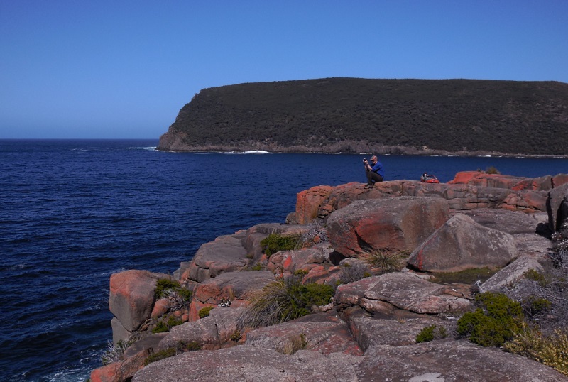
More uses for spare paddles
Bypassing Flinders Bay and Sommers Bay
where there are a few homes, we paddled across to Chronicle Point and then across Norfolk Bay to Whitehouse Point with a moderate wind from the
northeast. This afternoon sea breeze came up each day we were out,
some time between noon and 2.00 pm and it moved across the water in a
defined line. Conditions changed from glassy to choppy in a matter
of minutes always presaged by smooth rolling waves and the sound of
breaking waves.
Paddling past Whitehouse Point on a very calm day
From Whitehouse Point, the paddling was
more interesting as we had the multi-hued sandstone cliffs to look at
and the waving beds of many different sea weeds easily visible in the
clear water below our keels. At Green Head we turned south and had a
tailwind for the final two kilometres down to Lagoon Beach. After
almost seven hours in the boats, we were certainly ready to land and
make camp.
Decisions:
"I need you to listen," said
Doug as he came back from the higher dunes with the latest marine
forecast. The always a bit iffy forecast had deteriorated to another
series of strong or gale force wind warnings and we needed to give
some thought to whether or not we would continue with our planned
route. But, at 5.00 pm, after a long day in the cockpit, I knew I
was not going any where, and, as the sun dipped and the wind blew,
getting back into damp clothes and a wet boat was very unappealing.
After dinner, hot drinks, a walk on the
beach, we crawled into our tent and considered our options.
Continuing on meant getting up in the dark the next morning, packing,
setting off at first light and paddling south for 30 km where we
hoped, but were not completely sure, we could land on the north end
of Wedge Island to make camp. A 20 knot wind was forecast to arrive
by around noon. If we were lucky, we would only have to push into it
for the final two, or perhaps three, hours. The following day, we
needed to paddle 33 km in a two to three metre swell, a one metre
sea, and, with luck, light and variable winds. That distance of 33
km was contingent on a surf landing on the southerly facing beach at
Crescent Bay, which, really seemed unlikely given our limited
(virtually none) experience in surf landings. Paddling into Safety
Cove to land on a sheltered beach would add four more kilometres.
Fragile start to life, Pied Oyster Catcher eggs
The third day and last day of the
forecast period had a strong wind warning for southerly winds and we
knew without deliberating that we would not set off to paddle around
Cape Pillar and Tasman Island in that kind of weather and sea. The
fact that this fourth day would be another long one - 34 km - with no
landing sites was really irrelevant. Our fifth and final day on the
water would be relatively short at 20 km and familiar as we had
paddled the section of coast from Pirates Bay to Fortescue Bay
before, and, while there were no landing sites, there were also no
prominent headlands and currents were mild.
I was so tired I was asleep by 8.00 pm,
but, before we both drifted off we made a tentative plan to continue
toward Wedge Island. We could always paddle into the sheltered Wedge
Bay where a series of small hamlets line the coast. With luck, we
might even be able to take the once daily bus from Nubeena back to
our car at Pirates Bay.
Early morning fog over Lagoon Beach
We had a cold and slightly damp night.
Mesh tents like ours (MSR Hubba Hubba) are not really that
practicable under certain Tasmanian conditions. When the dew is
heavy and the night is cold, the moisture in the air condenses inside
the tent on your sleeping bag or drips from the fly through the mesh
onto your sleeping bag. Either way the night is damp and cool. At 5
am, when we should have got up, I was huddled in my bag having spent
the last two hours curled into a ball to conserve heat. For perhaps
the first time, I felt old, all my 52 years seemed to sag onto my
body. Getting out of our wet tent, into damp clothes, packing up,
and paddling hard for six or eight hours was just not going to
happen. Doug was also awake and, after checking the marine forecast
again, we decided, surprisingly quickly, that we were going to turn
back.
Day Two: Lagoon Beach to Monk Bay
With the pressure
to make steady progress into uncertain conditions relieved, I felt
much better. This was a trip that I knew was too hard, both
physically and technically for me at my current level of expertise,
and, I did not feel that deepening disappointment with myself that I
usually feel when I turn back out of fear not lack of ability.
Turning back when prudent seems reasonable, but turning back because
of cowardice carries the connotation of failure.
We stayed in the
tent for a little while, but the sun was slow coming so I got up and
put the kettle on. It was a beautiful morning, clear except for fog
that was drizzling slowly over the sand dunes from the brackish
lagoons behind the beach. The fog spread across the surface of the
ocean and dribbled out towards Sloping Island. A Pied Oystercatcher
was sitting on its nest of speckled eggs scratched into the sand just
below us, while a second Pied Oystercatcher patrolled the beach.
Apart from the gentle swell rolling onto the shore, the morning was
silent.
Paddling past Green Head, PC, Doug B.
Now that we had no
fixed plans for the trip everything changed. Kayaking became about
the journey, not the destination. We had breakfast and hot coffee,
packed the boats, paddled south around Lobster Point admiring the
forests of kelp along the shore and landed on the north end of
Sloping Main Beach.
Back in the boats
we paddled back around Green Head and into Lime Bay. This is a
lovely sheltered but shallow bay with vehicle accessible camping,
and, infernal combustion access means bogans so after a look around,
we continued on rounding Whitehouse Point into Monk Bay. We found a
campsite on the small sand beach, with some sheltered rock slabs as a
kitchen area and had the inevitable brew. A well flagged but
rudimentary track runs all the way from Lime Bay down to Plunkett
Point and I strolled along this before dinner. The very best
campsite, that we found after unloading the boats and setting up camp
is actually a minute or two south of the sandy beach on a grassy
knoll above a pebbly beach.
Paddling into camp at Monk Bay
Day Three: Monk Bay to Dart Island
The next day we
continued our leisurely explorations of Norfolk Bay. The night had
been cloudy so it was considerably warmer and drier in the tent and
we paddled down the coastline passing Ironstone Point and Plunkett
Point. From Plunkett Point we skimmed Salem and Cemetery Points and
then landed on a rock platform at Deer Point for breakfast. Apart
from breakfasts in the high mountains, this must be one of the most
scenic breakfast locations I've ever experienced. Sandstone caves
arched behind a large flat sunny and warm rock platform all
surrounded by crystal clear water and waving fronds of sea weed. It
was a tough spot to leave.
Continuing east we
grazed along Premaydena, Glenila, Eli and Parkinsons Points. The
conditions were so calm and the water so clear that I could see crabs
swimming by under the boat and white starfish spotting the sea floor.
Amazing how ungainly crabs always seem, doomed to scuttle sideways,
but, they prove surprisingly efficient swimmers. At Parkinsons Point
the afternoon sea breeze blew up, moving across the water in a
straight line and we paddled into Newmans Beach where the tide had
exposed large areas of white sand and wandered about for a half hour
before using the spare paddle to prepare lunch.
Breakfast at Deer Point, PC Doug B.
We were only 10 or
12 kilometres from Pirates Bay yet without speaking about it we knew
we would stay out another night. It was just too wonderful to be out
on the water again where life is a simple matter of packing the kayak
in the morning, journeying through the day, and finding somewhere to
camp at night. Continuing north along the Symphony Hills we found a
couple of small pebbly bays where we could have made camp but decided
to try and find a campsite on Dart Island. On the southwest end of
Dart Island we found a tiny protected harbour and pulled the boats
in. Up under the tea-trees there was a sheltered grassy campsite and
out above the harbour some large rock slabs made a good kitchen. We
were soon setting up camp and brewing some tea. Before dinner we
walked around the island following the rocky shore. I found some old
stone fences and a lot of very fine netting in lines up in cleared
areas.
Over dinner we
watched the sun set over Norfolk Bay and I thought about what a balm
for the soul spending time in the wild is and how so many of our
current problems are likely caused, at least in part, by a severing
of the natural bonds between man and nature. Surely we would all be
better off if, for at least some part of each day, week and year, we
left behind motors and powered ourselves, whether by foot, by bicycle
or by kayak or canoe and went out again into the natural world to
watch the sun rise and set, to be awed by the wonder of the simplest
things, like crabs swimming through clear teal water, sea anemones
flowering in beach sand, sea birds sitting on delicate eggs on a
sandy beach or the way the wind moves across the water in a long
linear wave. We could journey with no real destination but a desire
to look into the next bay or around the next headland, to land on a
deserted beach, to take shelter from the wind behind tea-trees, to
lie on rock slabs warming in the sun, and we could remember our place
in the world and perhaps be motivated to live with more harmony and
less aggression.

Sunset from Dart Island, PC Doug B.
Day Four: Dart Island to Pirates
Bay
Our last morning
on the water and our last breakfast on rock slabs. Gulls and terns
wheeled and dived over the west end of Dart Island snatching fish out
of the water after plummeting in a free fall into the ocean. We
packed up and paddled across to Mason Point. The highway runs along
the south shore of Pirates Bay and, as we paddled deeper into the
bay, the sounds of civilization became more intrusive. Cars, buses,
motor-bikes roared past disturbing the eerie calls of gulls. I'm
always struck by how all of us in the developed world always have
somewhere we need to go, right now, as fast as we can. Are all these
journeys of such importance? I felt that the closer we got to our
own vehicle the more a part of myself cleaved off and went winging
back out to the deep green ocean.
Sometimes I think
about setting off on a very long walk or kayak, something that would
take not days or weeks but months. It's an enticing thought. A long
journey that would reduce life to its simplest form. Eat, walk or
paddle, sleep, do it all again the next day, and the next, and the
next. Continue on until simply moving becomes the goal.
Paddling into Lime Bay
Final Thoughts:
When we first
moved to Australia and got back into sea kayaking after a nearly
decade long hiatus, I got nervous paddling in a small wind chop and a
long crossing was about four kilometres. Since then I've paddled 18
km from the mainland to Pelorus Island, and on the Lizard Island trip, paddled north from Cape Bedford for two hours before even
seeing the tiny sand cay that was our destination. I've kayak sailed, albeit not very well, with a 30 knot tail wind, and pluggedinto a 20 knot headwind. In Tasmania, I paddled around both the
Freycinet Peninsula and Maria Island, but, I still have scant
experience paddling in ocean swells or landing in any kind of surf
bigger than about 60 centimetres. I cannot eskimo roll (except on
rare occasions) and I am acutely aware that I have not practised
rescues in real world situations and have no reliable bilge pump that
does not require the use of both hands. In short, I am better than I
was, but not as good as I need to be.
Unlike
mountaineering, which always seemed to me to be about the destination
- reaching the summit - I have always viewed kayaking as a process
rather than an endpoint. The journey is what makes the trip, not
reaching some arbitrary geographical point. So, although I embraced
the "move fast" mantra when climbing, it has not been my
motto while kayaking. But, I now realise that some trips I want to
do will require me to not only paddle more skilfully, but also paddle
faster. Perhaps the two are intertwined, I am too inexperienced to
know.
Leaving Monk Bay, PC Doug B.
In hindsight, I
wondered if I could have trained for this trip while we were
house-sitting in Campania. I could have paddled on windy days -
there were no shortage of those - gone out on days with big swells,
practised paddling the kayak in the surf, done some real rescues in
real cold water. But I realise, I did not want this trip enough to
do the required work during a Tasmanian winter. The air and the
water seemed too cold, the days too short, the effort involved (all
that driving!) too much. Moving inside might make you soft, or age
may simply cause the greater desires of youth to dim a little. Both
may conspire to make being cold, uncomfortable and scared much harder
than it used to be.
There are still
big trips I want to do in the kayak. I would love to paddle from
Mackay to Thursday Island. I have lately been wondering if it would
be possible to paddle right around Fraser Island. Paddling around
Wilsons Promontory is appealing, and, perhaps one day, if the fire
does not dim too much, paddling right around both Bruny Island and
the Tasman Peninsula. If I were really to dream big, it would be to
paddle right around Tasmania.
Paddling towards Deer Point, PC Doug B.
And while I day
dream about big trips, I loved this little trip in sheltered waters
that was not hard, scary or committing. I loved the quiet campsites,
the mirror like water in the mornings that echoed the hulls of our
boats back up to us. I loved peering deep into the startlingly clear
water and watching the gulls whirl overhead. The amount of life
bustling away in a single square centimetre of tidal sand amazed me.
I loved crawling into the tent tired from a day paddling as darkness
fell and waking to the sunrise in the dewy cold of the morning. I
loved every single moment of this wonderful trip that, had we not
turned back, we would never have done.