Monday, April 28, 2014

The Conundrum

We have all met them - either in real life or via the interwebs - the people whose behaviour the Dunning Kruger hypothesis was postulated to explain - the supremely confident, mostly incompetent adventurer whose own incompetence remains outside their own recognition. I've often found myself - almost - envying these folks. Semi-epics, minor failures, hasty and repeated retreats, and simple paralysis never seem to faze these folks. They can back down a hundred times and still be convinced they "live outside their comfort zone." 

Conversely, I find myself haunted by indecision, the spectres of past failures and retreats, the continual titration of my own level of competence against the expected challenges. At these times I wonder if it would be less angst provoking to simply stride (paddle) forth oblivious to the challenges ahead or at least completely convinced of my own ability to overcome any difficulties. And yet, I am not sure that the blindly oblivious achieve any more, and perhaps, in the long run, achieve significantly less, than those of us who make more prosaic assessments of our abilities. Ignorance may be bliss, but it seldom seems to result in unqualified success.

Embarking on, planning, mountain adventures, I always felt so much more confident and competent. I could tell from the map, the time of year, the conditions, where travel would be easy, where difficult and where, for me, impossible and was seldom surprised. Negative feedback got recycled back into my own assessment loop and informed future decisions. 

I rarely feel the same way planning sea kayak trips unless conditions are uniformly benign. I have no firm benchmark of my own competence to gauge what is and what is not within my level of skill and thus am unsure what combination of conditions and marine geography will prove too much. 

Planning our Whitsundays trip I am all too aware of the deficiencies in my own knowledge both of myself and of conditions. I have some grasp of the effect of wind, tide and geography and can make intelligent extrapolations as to how they will all interact, but, the crucial element, my ability to judge if my skill is sufficient to match the difficulty is missing. I simply do not know. I am stuck in the conundrum of not being incompetent enough to be completely unaware, and not being competent enough to be fully confident.

Sunday, April 27, 2014

Timing Is Everything: Around The Newry Islands

Port Newry, north of Mackay, is a strange doughnut of sheltered water bounded on the south by Point Finlayson and the Red Cliff Islands and on the north by Rabbit, Newry and Outer Newry Islands. At low tide, kilometres of mud flats dry out and the deep water is reduced to a small area, but, from Victor Creek there is a marked channel out to "deep water" that is accessible at all tides. After yet another change of plans, lunch time, and a moderately low tide, found us packing our kayaks on the beach beside the boat ramp. 

Dusk on Outer Newry Island

Luckily, we hadn't unpacked from the trip we didn't do a few days before, so packing was relatively quick and simple, and, at 2.00 pm we launched the boats and, with the tide falling and the wind behind, we sped out the winding channel sunk deep between mud banks and arrived at Outer Newry Island in about an hour. The tide was a long way out, and access to the camping area was via a passage cut between mangroves. We paddled over to Newry Island in case that camping area had better access, but there was a 0.5 km carry on that island too over similar muddy shores. We came back to Outer Newry, unpacked, brought the boats up and found the camping area, a nice cleared area among eucalypts at the top of the island. Before dark, which falls early in the tropics, we just had time to walk down the trail to the rocky east side of Outer Newry Island and explore a little of the fantastic sandstone cliffs that lie along either side of a rocky bay. 

 Doug on the north side of Outer Newry
near Wedding Cake Rock
 
On Saturday, we set out to circumnavigate the island group, a distance of about 24 to 28 km. We paddled south down the east side of Outer Newry past sandstone cliffs and towers and across to Mausoleum and Rocky Islands. Rounding these on the south side we crossed along the south shore of Acacia Island and pulled in for a break at Tug Point on Rabbit Island where some yobbos were working on the slogan "Australian Yobbo Camps: A New Level Of Filth". We were eager to leave this camp before the yobbos returned and continued north up the east side of Rabbit Island past several nice beaches (at least at this tide) around the north end of the island and then began the slog into the headwind down the west side of the island. This was a race against the tide as the entire west and south side of Rabbit Island dries all the way to the mainland at low tide. The water was very shallow in parts, but we made it to the west side of Newry Island before the tide dried everything to the west down to mud. 


Doug near the rock stack on the east side of Outer Newry Island
 
Up until 2001, a low key resort operated on Newry Island and track leads from Sunset Beach (the west side) round to the old resort area where a few bits of buildings still stand. We strolled around this 3 km loop and returned to find the passage between Newry and Rabbit Islands completely dry. The south side of Newry Island has water at all tides and we were able to paddle back to our campsite arriving half an hour after a heavy rain storm. 

 Bad timing for the mud flats
 
We packed up and left about 8 am the next morning as we wanted to catch the tide running into Victor Creek. Just as we launched the boats, a tinny of yobbos arrived. The last thing I heard was "There's plenty of fucking wood here if we want to start a fucking fire" (fires are banned on the islands for obvious reasons). Timing is everything.

Doug and Sandy: The Change Of Plans

The morning of our planned departure for our Whitsunday trip the weather and forecast was just a bit worse, and, after an hour of dithering, we decided to do what we do best, change our plans. Somehow, in a move that still makes sense, but may be rationalisation, we convinced ourselves that delaying cost us nothing as, should the forecast/weather improve in a few days we would have made the right choice. Conversely, should the weather/forecast stay the same, we had lost nothing and would simply do the trip a few days later. 
Accordingly, we packed up, drove south of Bowen and up onto the Mackay Highlands where the wet season was still going strong and it rained, misted, dripped, and generally precipitated for our two day stay. 

Fig Arch

We did not let the rain deter us, and visited Finch Hatton Gorge, a rocky small gorge featuring a dozen waterfalls of different sizes. A 4.2 km return walk takes you to the highest fall and there are a series of nice swimming holes along the way - not needed by us as it was raining enough for a shower. The leeches, which we hadn't seen since Lamb's Head were out in force. I got one on my wrist and my entire forearm swelled up which makes me think I am becoming allergic to leeches the way I became allergic to wasps, bees, and hornets. Apparently, there is some cross-reactivity and, rarely, people have anaphylactic reactions to leeches.
We stayed the night at a soggy camp area at Crediton Hall near Eungella National Park, wore long pants, and, slippers (!) and used our blankets for the first time in many, many months. Next day, we walked a 10 km route from Broken River picnic area to Cedar Grove at Eungella - or rather I did, and Doug kind of did. We did our usual walk through with Doug starting at the Eungella end while I started at Broken River. The track is well maintained but very wet and muddy and the leeches were multitudinous. I had repellent up to my thighs, then pants tucked into socks sprayed with more repellent, shoes on top, and the whole ensemble sprayed again with more repellent and I still picked up dozens. Luckily, I sustained no bites as I had salt with me and liberally applied it every time I spotted one of the nasties. Doug had been less thorough with his applications and got more leeches. 
 
We met at Sky Window lookout where there was a view of nothing, the Pioneer Valley 700 metres below was obscured by cloud and, while I finished up the track, Doug finished up walking down the road. I walked along the road to the start of the track that leads up the "rainforest ridge" after we had lunch in the caravan but nothing would entice me to go down that leech ridden "track" eerily reminiscent of a Misty Mountains track. I got a leech just looking at the sign.

 Pioneer Valley from Sky Window

Next day, we had enough of rain and drove back down to the coast. The cloud had cleared and we could see the view down to Pioneer Valley from Sky Window Lookout. On the lowlands, we got the forecast again and, as before, Tuesday or Wednesday was looking perfect for departure on our Hook circumnavigation so, on a whim, we decided to paddle out to the Newry Islands for two nights. But that is another change of plan.

Tuesday, April 22, 2014

The Alternate Plan

Robin Tivy, master raconteur, tells a comic tale about an extended canoe trip in poor weather, during which the party was stuck for multiple days, until finally, Ralph berated the guides (Robin was one) for not getting the group moving and, was known forever afterwards as "Ralph of The Alternate Plan" - the capitalization is deliberate, and the relevance should soon become obvious. 
 
The day after we returned from our Gloucester Islands trip, while still feeling some post-trip fatigue, we began planning our next kayak trip (such is the nature of adventurers). The weather forecast, while typical for this time of year (southeast winds to 20 knots with scattered showers) together with three metre tides in the main Whitsunday group, and the confusion of eddies, overfalls, whirlpools, tidal rips and "unsafe passages" marked on the nautical chart has convinced us that this next trip will not be as benign as the last. 

Doug in a wave trough on the east side of Gloucester Island

Heeding the message of "Ralph of The Alternate Plan" I spent hours studying the chart, the tides, and the beach access to come up with a circle route that minimises our exposure to all the many and varied hazards of the trip. Climbers would think of this as mitigating objective hazards. Even though our Hinchinbrook Island adventure was almost a year ago, the lessons learned are still freshly imprinted on us. We have another year of paddling experience which has included many long crossings, some rough water, and some small surf but, we still question our ability to handle big standing waves, eddies, overfalls, and all the rough water that accompanies strong tidal currents, complex geography, and 20 knot winds. 

 Sunrise on the water
 
In truth, I don't have an alternate plan. I have planned a route that takes us in a counter-clockwise loop around Hook Island. If things go according to schedule, we should cross the major channels when the wind and tide are running together (wind against tide creates larger standing waves), and we should pass the most exposed points at slack tide. There are so many nautical hazards in the Whitsunday Islands, however, that it is impossible to plan a trip that tackles every hazard at slack tide so there are many places where we will simply have to "get up against it" and see how it goes. The problem with sea kayaking is that retreat is not always an easy or even viable option. Travel in these small but elegant craft, can make you feel infinitesimally small and vulnerable. Imagine multi-pitch climbing with a bouldering pad instead of a rack and rope and you capture some of the spirit of sea kayaking. 


The Nature of Adventure: Airlie Beach to Bowen by Sea Kayak

Over 20 years ago, Doug and I did a nine day sea kayak trip around the Whitsundays using our Feathercraft double “folding” kayak. We were both between jobs – a delightful six month hiatus during which we kayaked around the Solomon Islands, through Marlborough Sound in New Zealand, as well as whitewater paddling on rivers in southern NSW. All these years later I can only remember strange and seemingly unrelated details about our Whitsunday trip. I know we were hungry. We had no transport and all the groceries we brought on the trip had been arduously carried on my back from the grocery store some few kilometres distant under a baking tropical sun. Shocked by how full my back pack was getting, I just, at some random point, stopped. It turned out that I stopped a wee bit too soon. Aggressive white tailed rats (a native rat) chewed everything at the camp at Whitehaven Beach and we were so afraid they would chew a hole in the fabric skin of our kayak that we anchored it off-shore (the only time we have ever done this) overnight. And, finally, on one amazing day, we shot through Solway Passage on the incoming tide and, riding tides and wind, raced back towards Airlie Beach on one of the most effortless days of paddling I had ever had. 

 Doug heading north a tiny island paradise
 
Here we were again, launching from Airlie Beach, but, instead of heading east to the main Whitsunday Islands, we were heading north, along the shores of Dryander National Park to Gloucester Islands National Park, a group of island rumoured to be quieter and less busy than the bustling main islands of the Whitsunday Group. As usual, we were amazed at just how much gear can be stowed away inside a sea kayak and, in light winds we paddled north with our kayak sails listlessly catching the minor breeze as we ambled north passing narrow headlands, deep bays, and scaring turtles as they surfaced in the aquamarine water. 
 
Our first nights camp was on the northern side of a long spit of land (Grimstone Point) sheltered under large shady fig trees behind a sandy beach. The tides in the Whitsundays are some of the largest on the east coast of Australia so we were timing our departures as much as possible to catch favourable tides. Mornings, instead of rushing out on the water early, were spent bouldering on the granite boulders and slabs of the rocky shorelines or wandering along the beach. 

 Moon rise, Saddleback Island
 
Our second day was one of those wonderful paddling days that unfold seamlessly. With the ebbing tide, we paddled north to Grassy Island, where we stopped on an exposed rubble coral beach to stretch our legs. The winds, which normally blow at around 20 knots from the southeast at this time of year (the trade winds) were light, so even south facing beaches were benign. From Grassy Island, we passed tiny Edwin Rock and landed on a steep sand beach on the west side of Olden Island for lunch. Swimming off the beach was wonderful and turtles dandled by as we had lunch. The east facing cliffs leading to George Point offered some bumpy water and the current was running around George Point but nothing very intimidating. Rounding George Point, Saddleback Island cut a distinctive silhouette against the tropical sky. 
 
The campsite on Saddleback Island is on the western end of a large sandspit. On the eastern side, a rocky reef dries at low tide and provides interesting foraging. That night, as we sat having dinner under a daylight bright full moon, I began to think that perhaps, with the benign weather we were having (our second day of light winds with three more forecast), we should have been out on a "bigger" trip. Back in Cairns, I had planned out a series of different trips around the Whitsunday and Cumberland Islands and, we had chosen to start with this modest trip, because, after the long wet season in Cairns we did not feel in great paddling shape for long (30 km) crossings and rough water. Such is the nature of adventure, or perhaps adventurers, even while you are on one trip, you begin to dream of the next. 

 Sunset on Gloucester Island
 
From Saddleback Island, we meandered past Manta Ray Island arriving at Gloucester Passage around slack tide and paddled easily across to the southwestern shore of Gloucester Island where we found a deluxe campsite under a huge spreading many trunked fig tree. Along the beach, a freshwater stream ran out into the shallow bay and, walking up the rocky creek under massive paperbarks we washed off the days salt each evening in the cool, clean water. 
 
Gloucester Island runs north-south for 10 km and has a rugged spine of 500 metre peaks jostling up the centre of the island. The western side with sheltered sandy bays and rocky beaches is popular with power boaters. The eastern side features steep red rock cliffs, deep sea caves and only a few scattered rubble strewn bays mostly exposed to the easterly swell. On another day with light winds, we circumnavigated the island paddling in close to the red rock cliffs, nosing into caves, and landing on the steep rocky beaches. Paddling into the only campsite on this side of the island, East Side Bay, we were jostled by standing waves where the orientation of the island changed from north to west. In stronger winds, this would be a much more treacherous stretch of coastline. 

 Early morning
 
We paddled into Bowen via Middle Island, a day which required an early start, and we were on the water before dawn, and, kayak sailing with a beam wind, we were just able to crane around and watch the sun rise in a spectacular flame of colours over Gloucester Island. The wind helped and we made good time covering the 9 kilometres to Stone Island from Middle Island in about 1.5 hours. Again we were just around slack tide paddling into North Entrance past the disused lighthouse on North Rock and suddenly, after a week out on the water, we were back again among people in a town.

Saturday, April 12, 2014

A Birthday In Bowen

Today I turn 51 and I am celebrating by huddling in our caravan in Bowen as wind and rain lashes the north Queensland coast and tropical cyclone Ita creeps ever closer. Right now, the eye is crossing over the southern edge of Townsville and, if the forecast track map is correct, will cross us sometime this evening. Ita has been downgraded to a category one, which means winds will “only” be in the 50 to 60 knot range and rainfall might only total 400 mm. Even early this morning, my “reality distortion field” as Doug calls my ever optimistic outlook, was fully operational and I could not conceive of any really destructive wind or rain affecting us. Suddenly, the situation is looking significantly more hazardous and my “reality distortion field” is beginning to buckle. But, as Doug quipped just moments ago “it's too late to do anything now.”
It's hard to focus on anything much with the maelstrom outside and a lot of uncertainty inside (our caravan and my head), but, with at least six hours until the worst of the cyclone arrives, I need to do something to fill the time, so I may as well chronicle our latest travels since we paddled in Upstart Bay. 

Gloucester Island from Murray Bay
 
We arrived in Bowen a couple of days ago. I haven't got a good feel for the town yet, but, it is just south of the infamous Abbot Point project and at the northern end of the Whitsunday Islands. From the lookout atop Cape Edgecumbe, Gloucester Island hulks – or maybe it was only the sonorous weather yesterday that made it appear so – to the east. Bowen is a much less touristy town than Airlie Beach, which is just a short distance to the south, and that can only be to its favour. There are a series of nice beaches scattered around the headland of Cape Edgecumbe which are a little less brown, muddy and tidal than is the norm for north Queensland beaches, and the entire cape is dotted with large granite boulders featuring slabs, overhangs, heucos and chicken heads. It is, in other words, a boulderers dream location.
Strangely enough, the bouldering guide for Bowen is nine pages long versus 145 pages for the Harveys Marbles bouldering guide, but, there must be nearly as many problems. The lack of documentation probably has more to do with there being fewer active climbers in the area than there are in Townsville than the quality or quantity of the bouldering. 
 
We both got out bouldering the day we arrived and, being a concrete sequentialist, I started at the first area featured in the on-line guide that coincidentally was the first area I arrived at walking down the beach to the bouldering from the caravan park. I'm getting much better at “seeing” the problems on boulders since I have been bouldering more and I had a great couple of hours playing around on some big boulders sitting on the sand – nice landings but wet sand sure does stick to rock shoes. Around 3.30 pm, the bugs – sandflies and mosquitoes – came out, which is a couple of hours before you would expect, and, having no repellent with me, I got chased away. I left Doug playing about as he never seems as attractive to biting insects. 

Boulder problems at Murray Bay
 
The next day the weather was quite tenebrous and I wasn't expecting much from the day. Doug had work to do (the never ending project) and opted to stay behind as he is quite keen to get this project finished. I packed up my rock shoes, some food and water, a brush (for the sand), repellent, and headed off exploring. I decided to walk the loop trail that leads around Cape Edgecumbe and, by the time I walked the 1.5 hours there and back, that took most of the day. There are amazing boulders and small rock walls all around this peninsular. You could easily spend several days or even a couple of weeks, moving from boulder to boulder, jumping into the ocean for a swim when you get hot. There are several look-outs on the peninsular, all of which offer superlative views of the surrounding coastline and the Whitsunday Islands, although with the lowering clouds I had, much of the islands was obscured. I got onto some wonderfully textured boulders at Mother Beddock look-out and discovered that I was actually feeling pretty tired from the day before, which, like everything in life was good and bad – good I got a decent work-out the day before, bad as the boulders I passed looked so much fun. 

Bowen's Five Gallon Buckets route, perhaps a half a gallon?
 
I gave up on the bouldering for the day and settled in to enjoy the tracks, which were quiet even on a Sunday, but, as I passed the pretty little cove of Murray Bay I could not resist a few laps on the big heucoed boulders on a rock shelf on the south side of the beach. One problem in particular reminded me of the classic and ultra-popular “Five Gallon Buckets” route at Smith Rock that usually has a queue to climb it. The route is shorter at Bowen, but, in the time you stand waiting at Smith Rocks, at Bowen you could do a dozen laps, explore a few other problems, and take a swim.

Friday, April 11, 2014

Kayaking in Upstart Bay

Upstart Bay is a big sheltered bay south of Ayr and bordered by Cape Upstart on the east and the mainland on the west. There are few places to access the coast here as the land is low lying, marshy and criss-crossed with tidal deltas. Molongle Beach, six kilometres off the Bruce Highway is the closest accessible location to Cape Upstart National Park where we wanted to have a day paddle, so we drove out to the end of the road, and the rather depressing looking caravan park and somewhat less dismal private boat ramp (box for donations on site or join for $80/year) to launch the kayaks. 

What you see at Molongle Beach is what you get. A small caravan park with too little greenery, vegetation and space, a dredged channel through tidal mud-flats and lots and lots of small tinnies (Australian for both a beer in a can and small run-about motor boats, both of which are found in abundance at Molongle Beach). The location can only be popular because the waters in the bay are so sheltered that half-cut fishermen can drive small tinnies about with impunity regardless of wind speed. There does appear to be a good stock of marine life in the bay – we saw half a dozen large turtles, a few sharks and rays and lots of fish jumping. 

It is about a kilometre paddle down a dredged out creek to reach Upstart Bay and when we poked our noses out into the bay a fresh easterly wind was already blowing about 20 knots. Cape Upstart has a 700 metre peak on the northern bulbous end of the Cape, but to the south of this, the land is low lying and the wind screams over the mangroves unimpeded. We had hopes of paddling towards Cape Upstart but the fresh winds meant that most of the day would be spent paddling upwind. We decided to head for a point of land almost due east and about 7 or 8 km distant. From there, we hoped to get some protection from the wind to paddle north towards the Cape. It took almost three hours of steady pulling to reach the small tip of land protruding from a large mud-flat on the western side of the neck joining Cape Upstart to the mainland. Luckily, the waves remained small as when any slightly bigger ones came across the bow, I felt the boat pretty much stop. Mud flats dry out for almost two kilometres off shore here, and it was difficult to find anywhere to stretch our legs from our morning in the boats, but we did manage to stand upright for a few minutes on an oyster encrusted pile of rocks. 

 Huge sand flats in Upstart Bay

To the north, a sandy beach looked appealing for lunch and we set off in that direction. I put up my middle sized sail but found I was getting blown as much to the west as I was to the north and I had to lean right over to prevent a capsize so I stripped the top off and went with the 0.35 square metre sail which performed much better. We reached the sandy beach in about an hour and discovered that it too was a bit boggy, not muddy, but definitely pretty soft to walk on. We each had a walk about and some lunch and then realised that time was getting away and we would have to head back. The sails were useful even with a beam wind and we sailed and paddled south until we had a pretty straight shot back with a tail wind to our launch site. I got stuck in mudflats before the channel and ended up having to pull my boat along and then, when I re-entered in deeper water I dragged a couple of kilograms of black mud into the cockpit. 

 Doug sailing back to Molongle Beach

As usual, when the wind is behind you, there seems to be so much less of it, which we later realised is due to the fact that you are moving forward at a certain speed which reduces the wind filling the sail. In any event, we went up to our mid-sized sails and really should have gone up to our full sized sails to get the most from the wind. When I was back at the caravan looking at the map, I did wonder if we could have got where we were going much faster and with much less effort if we had headed northeast instead of east and then north. Sometimes, we do seem to be able to sail fairly close to the wind. It would be nice to paddle around the north end of Cape Upstart but the only way I can see to do that is to leave from Bowen and paddle the full length of the coast up to Townsville and that would take about a week.

Tuesday, April 8, 2014

Swat Season Walks Around Cape Pallarenda

Cape Pallarenda and Townsville Town Common are two adjacent conservation reserves (it would seem to make sense to amalgamate them but that does not seem to be the Australian way) close to downtown Townsville. Doug had some work to finish up (the project that never seems to end) so I left him sweltering in the caravan in front of his computer and went off to swelter on some walks. 

I decided to do a loop walk west along the Many Peaks trail to Mount Marlow then return via one of the lower level trails that cross back past the wetlands. I gave myself a cursory spray with insect repellent before starting but decided against carrying it with me. The track starts out as a big broad road, and, if you followed the Lagoon track, this is how the track would continue. I, however, took a turn to the north and began climbing a well cleared trail that soon reached a lookout with a view over the extensive wetlands that surround Townsville and go some way towards explaining why Townsville is so buggy. 

After Tegoora Rock, the track deteriorates a bit and plunges into moist forest that is swarming with mosquitoes. It is just under six kilometres to Mount Marlow and the track is below ridge line all the way contouring along the south side of the east west ridge system and alternating between open forest with chest high grass and dense timber. The biting insects are horrendous and I soon came to regret not bringing repellent with me. It was hot and sweaty but I could not stop to drink, admire the view, or take photos for fear of losing a few litres of blood. 

 Freshwater Lagoon

Just east of Mount Marlow, the track climbs up onto the ridge top on a wide grassy hillside. All the way to the top, the bugs were swarming, but, at the very top, the grass recedes from chest high to knee high and enough breeze was blowing over to allow me to stop, drink, take photos and generally enjoy the location.

The way ahead is much clearer as the trail switches down past a large impressive boulder about 15 metres high that could, were the National Park service to allow it, feature some good sport climbing routes. Apparently, there used to be a couple of bolts, but bolting is now banned and the rock has no cracks for natural protection, besides which you'd be hard pressed to get off without a rappel anchor. 

 Looking north from Mount Marlow

At the junction of three trails I decided to take the Freshwater track back as it seemed the one most in the open and likely to have enough breeze to keep the bugs in abeyance. This track crosses along a gravel pad with wetlands on either side. I saw many birds, brolgas, herons, ducks, ibis, sea eagles and other raptors, but got photographss of none. There are two bird hides but these block any wind and were infested with biting insects. 

South to Magnetic Island

There are a couple of other circuit walks you could do, including walking out to Shelly Beach. The tracks are very quiet. I walked on a Sunday when the nearby park was teeming with people and did not see anyone. Tropical strength repellent would make the trip much more enjoyable although the constant whining drone of mosquitoes might still drive you crazy. I'm not sure how much better the bugs get in the dry season. Certainly, at the end of the wet season it is full on swat season.

The Leader Never Falls: Shifts in Risk Perception

When you are on a 14 to 16 km crossing there isn't all that much to look at from the cockpit of a sea kayak, and, focusing too closely on your destination serves only to make the distance you need to travel before you reach land seem further. The easiest thing to do is to paddle as efficiently as you can and then, conditions permitting, allow your mind to wander. Paddling out to Rattlesnake Island in light winds, with our sails up, apart from the usual discomfit I feel at having to lean my boat to one side when using the sail in a beam wind, my mind was wandering freely. 

 Rattlesnake Island in the distance from Toomulla
 
I thought about how much I had enjoyed paddling with our Cairns friends. As any outdoor adventurer will tell you, sharing adventures with friends, both new and old, makes even the most mundane trips special. But, I also thought about how much faster and smoother a small group of two, or perhaps three at most can travel. Doug and I were up at 4.30 am and on the road by 5.00 am. Deciding on a launch location, unloading gear and boats, and packing to leave was quick, efficient and did not require long discussions to make everyone happy. That kind of speed and flexibility is hard to achieve with a bigger group, not impossible, but often overwhelmingly difficult.

It's interesting as well how our risk tolerance shifts. When Doug and I first started sea kayaking in Queensland the 12 km crossing from Gould Island to Coolah Island in the southern Family Group filled us with apprehension and required careful planning to ensure we had a period of calm winds. Now, we tossed off a 14 km crossing with winds forecast in the 15 to 20 knot range without any qualms. In fact, if the winds turned out to be less than forecast we would be grumbling about not getting sufficient push in the sails. The academics involved in accident prevention have a term for this (although I can't remember what it is). Essentially, so the theory goes, as new innovations are introduced to reduce risk (like air bags in cars), people increase their risk taking behaviour to compensate for the increased safety of the activity and accident statistics remain static. 

 Doug on the sand spit on Herald Island
 
Long crossings seem a lot like multi-pitch rock climbing to me. As you near the end of your lead, with your rack of gear looking frightfully scanty and searching for a spot to build a belay, there is a feeling of being all alone. Somewhere, perhaps 50 metres below, your partner is paying out rope and will hold you if you fall, but, they can't help you find the route, make the right moves, plug in more gear, or build a belay. You are on your own for all those things. Your partner is there, but, at the same time, not really present. Crossing to Rattlesnake Island felt much the same way. Doug was paddling off to my side, perhaps 60 metres away. Were I to capsize, he could provide assistance to get me back in my boat, but, it would take him some time to notice I was missing, to turn around, and find me among the wind waves. In the sort of chaotic conditions in which a capsize is likely although your partner may be a scant 60 metres away, there is really only so much they can do for you. 

 Herald Island sunset
 
That night, as we sat on Herald Island watching the sun set, Doug likened sea kayaking in north Queensland to sport climbing. Falling on sport climbs (if they are sensibly bolted) is relatively safe. Injuries are rare, and most often result from climber error (like getting off route, or having the rope around your leg). You can climb right near, or even past your limit with relative confidence that the worst that will happen is a drop onto the rope. In northern Queensland, with the Great Barrier Reef blocking major ocean swells, the warm water, and predictable currents, capsizing doesn't seem that much worse than falling off a sport climb. Capsizing off the coast of Canada, however, with icy cold waters that cause fatal hypothermia in minutes, is a bit like falling off an ice climb – and we all know that when climbing frozen waterfalls “the leader doesn't fall.”

Saturday, April 5, 2014

Caught in the Crosshairs on Rattlesnake Island

Doug and I were crouched on the beach on the western side of Rattlesnake Island afraid to raise our heads as a volley of gunshots cracked in the still air. For the second time in three days, I was talking to the Townsville Harbour Master: “Are there any military exercises ongoing on either Rattlesnake or Herald Islands?” I asked, “I'll just check for you,” the same woman I had spoken to two days ago said. “No, nothing today, tomorrow or the next day she said.” Strange I thought as another rapid fire burst of shooting cracked over our heads. 

We had left Toomulla Beach at 7.30 am, and, with light southeasterly winds we had made the 14 km crossing to Rattlesnake Island in about 2.5 hours. Paddling in to the enclosed bay on the western side, we thought how beautiful this isolated island was. A large fig tree – the only one on the beach – offered shade and a good camping spot and we made straight for it. Dragging our kayaks up the beach, we unloaded some gear, and then wandered out to the end of a prominent sand spit. Overhead, a large military helicopter flew loops around the western side of the island. We thought it a bit strange that a war ship appeared to be anchored off the southern side of Herald Island – the next island to the east – and that a military helicopter was in the area, seemingly dropping troops on the island, but, the Harbour Master in Townsville had assured me that there were no military exercises currently running on the islands. 

Sandspit on Rattlesnake Island

Back at the fig tree, we began to think about breakfast, but, got no further than contemplation as a burst of gun fire rent the morning air. “Must be just a little target practice” we thought, but, soon a veritable fusillade of shots followed and we were hunkered down on the beach afraid of being shot. After calling the Harbour Master, and, not feeling very reassured, Doug suggested we try contacting the war ship. In the stress of the moment, all the radio jargon we had learnt with Nelson Search and Rescue was lost, and calling ourselves “Kayak One” we managed to make contact with Warship Chules. The radio operator on Warship Chules seemed as confounded as we were to find a couple of civilians on the beach, and, after asking us to switch to channel 69 and “maintain our current position” he called a halt to all the shooting. Apparently, it was live ammunition. 

Shortly, two large men, decked out in traditional army camoflauge gear (which must have been awfully hot under the tropical sun) appeared on the beach, followed soon after by two more army personnel in a small zodiac, and, standing off-shore was a large yellow Army speedboat with yet more army personnel. We conversed with everyone, making sure that they all knew that we had contacted the Townsville Harbour Master before proceeding to the islands. After hastily reloading our kayaks, we launched into the stiffening wind and, with two army boats as escort, and a large helicopter flying over head, we paddled east to Herald Island. A third boat met us at Herald Island, and, again the details of who we had contacted were taken and we were given permission to camp on Herald Island and informed that the operation, which would last a total of three weeks, would be suspended on the following day for the weekend and we would be free to visit all the islands. 

 Magnetic Island from Herald Island

Herald Island is just as beautiful as Rattlesnake Island. Another large sand spit was occupied by the army on the southwestern end, but we found a large fig tree on the beach to the north that offered shade, large flat plates of dead coral for a kitchen and flat ground for camping. We unpacked the kayaks for the second time and made lunch.

After lunch, we wandered north up the beach and rock-hopped past boulders and rock pools until we were high on the eastern side of the island and could look south to Magnetic 
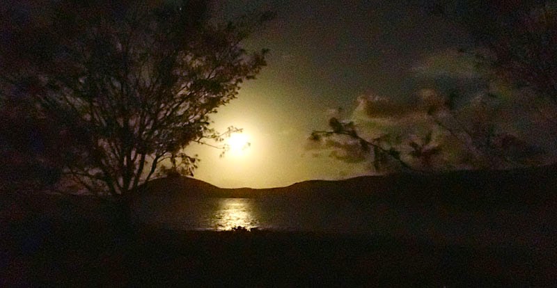
Island. That evening, the military pulled out, the sun set in a blaze of colour over Rattlesnake Island, a cooling wind blew, and we slept soundly in our mesh tent with a view to the stars. 

 Sunset from Herald Island

Next morning, I rock-hopped east to the eastern tip of Herald Island and then came back to camp for breakfast. We lazily repacked the kayaks and circumnavigated Herald Island. There was confused water off the eastern point of Herald Island but, our fully laden kayaks felt very stable. We sailed between Herald and Rattlesnake Island and along the southern side of Rattlesnake Island and back to the fig tree we had hunkered under the day before. The afternoon passed as it usually does on kayak trips, practicing eskimo rolls, snorkelling – Doug saw a huge turtle near the rocky reef on the northen end of the beach - and beach walking. It rained in the night and we had to jump out of bed and throw the fly on the tent. 

Next morning, the winds were light from the southeast and the mainland was shrouded in cloud. We could not see the houses of Toomulla Beach so spent the first half hour paddling west on a compass bearing. Gradually, we began to see the large white houses on the hill side above the small coves of Toomulla Beach. After an hour, when we were about half way across, a large shower, that had been creeping up behind us, enveloped us and we could not see land in any direction. We paddled on blindly for a while, but, it was hard to keep track of our direction simply by judging the angle of the waves and the gradually decreasing wind. I had no confidence in my old compass bearing, so we used the mobile phone to get another bearing. By the time we had done this, the clouds cleared enough for us to see Toomulla Beach and the remainder of the paddle was uneventful. 

 Doug paddling around the northern end of Herald Island

The premier trip in this area is to island hop from Townsville up through the off-shore islands of the Palm Group to Lucinda, or, if time permits to continue north along the east side of Hinchinbrook Island.

Tuesday, April 1, 2014

Happy Days on the Problemmettes at Harveys Marbles

Harveys Marbles, west of Townsville in the Hervey Range (yes, there was a mix up with the spelling) is, to quote the guidebook, “Queensland's premier bouldering location.” With that kind of billing, a climber just can't drive past. Access is easy, take Sharpe Road south from the top of the range, and drive until you reach the army gates. The Commonwealth of Australia (which you think would be the good citizens of Australia, but somehow does not seem to be) owns a big chunk of land in this area which is used for military manoeuvres and trespassing could result in you being shot, intentionally, or unintentionally, in the end, it probably doesn't matter. Anyway, these are the gates you come to. 

A good trail heads up the embankment to the left (south) as you face the gates and this is one of the access tracks. We, as I have mentioned before, aren't great boulderers and have no bouldering pads, so, even though I had downloaded the 145 page guidebook, we didn't bother too much about working out where we were or what we were climbing. It takes enough time getting oriented at a crag with bolts and anchors to help. Working out where you are in a few dozen hectares of scattered boulders from a guidebook (no matter how thorough the authors have tried to be) is bound to be futile. 

 Some good problemmettes on the tall boulders in the background

We arrived around 2.00 pm, but didn't get out until 3.00 pm as there is no turn around at the army gates, the road is simply gated, and, we had to unhook our caravan from the car to get it turned around. That, and having some lunch, consumed an hour. The temperature was quite reasonable for bouldering and, given the shade, the breeze and the higher elevation than the coast, you could probably boulder here even in summer, although mornings and evenings would likely be best. 

Our first mistake was looking for big boulders. There are some tall highballs in the area, but, at least where we were, in the Inner Circle (the area which is quickest to reach and seems to have the densest concentration of boulders) the boulders are not that big. We started on a fairly obvious boulder (that I think, looking at the guidebook later, may have been Boulder #3 at Middle Marsh) and managed to work about three or four problems off that boulder. Exploring around in the same area we occupied ourselves for about 1.5 hours, often finding multiple different routes on the same small boulders. Because the boulders are fairly short, the longest we climbed were maybe five or six moves, we started calling them problemettes as problems seemed a bit overblown for the length of the routes. After a while, we wandered off on a deteriorating trail, but didn't find a big concentration of routes at our level again that afternoon and retired for traditional Australian “afternoon tea” at about the dinner hour. 

Next day, Doug managed to get his broken down computer working again which meant he had to finish the programming work he had on the go, so I spent the day out bouldering again. In the morning, I walked down to the Embankment to work some routes. I came back for breakfast, and then spent the rest of the day out wandering from boulder to boulder getting progressively braver with the routes I was doing which resulted in some brief moments of not quite terror. The motivation to not fall off as I mantled over the final few moves on what were, for me, high routes, was pretty high. 

This is probably the longest period of time I have spent outdoor bouldering – bouldering on artificial walls doesn't count the same – and I can now say I understand the appeal. There is something refreshing about heading out for a day with just some water, a chalk bag, and a pair of shoes and working on various problems (or problemmettes). There's no faffing around with gear, and ropes and anchors, and “on belay”, “off belay,” “take,” “lower,” and so on. You see a boulder, you see a line, you give it a go. What could be simpler?