Tuesday, February 17, 2015

Catcher In The Rye: Bushranger Bay to Rye Beach

Driving west from Flinders on the Mornington Peninsular the road dips down and crosses Main Creek and enters a small corridor of native bush all that remains in this area of otherwise cleared farm-land. Doug let me out here at Bushranger Bay Picnic Area and continued north to St Andrews Beach (or actually Rye Beach - but that comes further along in the story). I headed off down the track to Bushranger Bay along a narrow track cut into dense coastal scrub. The density of the bush is a bit illusory here, however, as this corridor of bushland is only a few hundred metres wide and every so often cleared fields are visible to either side.

The track was surprisingly busy with all manner of hikers, some looking moderately fit, others grasping hiking poles (on a flat track?), others carting around the usual Aussie metabolic belly. But, at least everyone was walking and enjoying a sunny, if rather hot, Saturday. Soon, some pleasant views of the coast open up and a side track to the lovely Bushranger Bay is reached. It would have been nice to duck down for a swim, but Doug always finishes these through walks (he starts from one end, I start from the other) before me so I figured I should continue on. 

  Bushranger Bay

After about an hour I came out at Cape Schanck parking lot and strolled around the half kilometre loop that visits various viewpoints and also gives access to a stony little cove. It was very busy with people everywhere. Unfortunately, there is no connecting track to take you from Bushranger Bay track to Two Bays track which continues up the coast, so I had to walk out along the road to get to the track head. I strolled along this track - bristling with people carrying eskies, buckets, spear guns and more, so there must be many vehicle accessible locations nearby to the track - passing the occasional lookout and soon coming to a track that descended to Fingal Beach. 

The Victoria Parks sign indicated that this was an optional low-tide access to Gunnamatta Beach and seemed preferable to walking through the dense coastal scrub so I took this side route down to the beach. I did wonder if this would mean I would, for the first time on the twenty or so occasions that Doug and I have done through walks, not cross paths with Doug along the track. 


 Looking towards Cape Schanck

There were a lot of stairs descending to Fingal Beach which explains why so many people were huffing and puffing on their way up. The beach has nice rock platforms with rock pools and very clear water and it was pleasant wandering north around a couple of small headlands to the long sandy stretch of Gunnamatta Beach. 

Walking out onto the sand at the south end of Gunnamatta Beach I thought I might have a bit of a slog ahead of me as the tide was rising, a strong hot wind was blowing into my face and the sand was a tad soft. But, it all wasn't too bad, although it was hot, and I was soon walking past all the crowds near the two parking areas set behind the beach. 

 Rocky beach near Cape Schanck

We had agreed that Doug would park at St Andrews Beach which, according to my map was the next beach to the north so I thought I had only a couple of kilometres - maybe three - to go. I wandered around rocks at one small headland and then got to Boag Rocks but the tide was too high to stay on the beach so I took the short detour around to the south end of St Andrews Beach where, thinking I was nearly at the end of my walk, I had a swim. The water was gorgeous - crystal clear and wonderfully cool. Another half kilometre along the sand and then I strode confidently up to the car park where a sign said "St Andrews Beach" but no car awaited me. Not to worry, I thought as a track led off to the north, undoubtedly to another car park. But, no, it simply dead-ended near some expensive looking houses. 

I trudged back down to the beach, continued north, trudged back up the dunes again at the next beach exit - a small dirt road with a few cars parked - but no Hyundai with two kayaks on the roof. Back down to the beach, trudge further north, wondering what I would do if I couldn't find the car. About a kilometre or so north along the sandy beach another dense cluster of people indicated another parking lot although my map clearly indicated this was Rye Beach, not St Andrews Beach. Off I went feeling more confident that Doug would be parked at this beach as it seemed to be the first beach he would have reached in the vehicle. 

 Gunnamatta and Fingal Beaches

I was feeling a bit hot, bothered and frankly hungry (I've got into the habit of never packing food with me as I don't seem to need to eat that often now that I'm not a carbohydrate-crashing junkie) when I walked up the beach to the car park and was happy to find our car parked in the first row. It's always interesting when you drive the distances that you walk and paddle as you suddenly realise that you have come quite a long way self-propelled and it probably took me half an hour or more to drive down to Cape Schancks where Doug was waiting in a hot and very buggy car park. 

We still had to drive all the way back to Stony Point where we were staying and I was really feeling like a bit of food, but, it was hot, and Doug hadn't had a swim so we stopped at Flinders for another wonderful swim.
Pulling into Crib Point, we decided to fill the car up with diesel as we were planning to take the boat to Tasmania in two days and figured petroleum products would be a bit cheaper on the mainland. I know I was hungry and a bit dazed with the heat (it was about 34C and the once blustery wind had died to dead still calm) and I guess that is why I put unleaded petrol (almost 24 litres of the stuff) into our diesel vehicle. Luckily, I did notice before the tank was full and stopped immediately, and, that marked the beginning of a bit of a nightmare.

The service station owner could offer no help other than "push the car out of the way" and call the motorists association. Doug made numerous telephone calls - a bit challenging as we had quite poor reception - to every mechanic he could find but, it was almost 5.00 pm on a hot sunny Saturday and the only mechanic we got hold off said he could not help us until Tuesday and the vehicle would have to be towed to his garage. Eventually, we gave up, pushed the vehicle off to the side and walked 3 or 4 kilometres back to the small caravan park where we were staying all the way trying to come up with some solution to this problem.

 Point Nepean beach

We had decided to ask the caravan caretaker if he had a siphon hose and if so, I would walk back up and try to siphon the tank that night. If that worked, we would take the train to the nearest town and buy several gerry cans to contain the siphoned off petrol the next day. Turns out, Gary, the caravan park caretaker is a real stand-up bloke, very true to the typical Aussie stereotype of being quite resourceful. Along with his good friend Peter, he drove us back up to the service station, towed oir car back to the caravan park and helped us drain out all the petrol from the tank by removing the fuel filling hose and siphoning the two tanks. Gary did not have a proper siphon hose so we all got to take turns sucking on a piece of cut off garden hose. Unleaded gas is disgusting. 

Eventually, we got all the petrol out we were going to (not quite empty) and Gary drove us back up to the service station with three gerry cans which we filled with diesel and, finally, about 9 pm, we managed to drive the car back to our site near the caravan. 

Doug on the beach at Point Nepean

We had been planning another sea kayak trip the next day, but, when we finally finished with all these shenanigans we were too tired and stressed out to think about that so after a very late dinner we crawled into bed. I slept soundly but Doug was awake worrying about the car.

Next day, we cancelled our planned sea kayak trip as we thought it a good idea to drive about without the caravan and make sure the car was running okay. Doug and I both hate driving so the idea of going out purposefully to drive was a bit confronting but drive we did. All the way up to Point Nepean where we walked along the Coles track and out to Fort Nepean and Point Nepean (very pretty) and back covering about 150 km. We managed to burn up enough fuel to put another 10 litres of so of diesel in the car and we figure the remaining petrol is now quite dilute and are feeling cautiously optimistic. 

Surfside at Point Nepean

Have You Done This Before: Somers To Flinders By Sea Kayak

Doug and I pulled into Flinders Beach right near the jetty where a kayak-fisherman was just coming ashore on his sit aboard. "Where have you come from?" he asked, "Somers" Doug replied and..... "have you done this before?" the kayak-fisherman asked. Of all the questions Doug and I get asked, this one "have you done this before?" always seems the strangest to me. I always answer politely (almost always with a "no") but, what I am eternally thinking is - if I'd done this before, why would I do it again? 

Somers is in Western Port on the south side of Mornington Peninsular. An off-peak only (four scheduled services a day) runs from Flinders back to Crib Point and would provide our transport back at the end of the kayak trip.
The tide was a long way out at Stony Point where we were staying, but we were easily able to launch the kayaks from the beach at the end of South Beach Road in nearby Somers. We spent a good half hour before we left getting chewed up by sandflies and putting our kayak sails together on the beach. We were hoping for favorable winds and a bit of a push along the coast. 

We cruised down to Point Leo along the mostly sandy shoreline getting an occasional lift from the wind, but it was blowing barely 5 knots and very sporadic. At Point Leo, we pulled in for a stretch and a drink, but didn't stay long. The wind was increasing and we had hopes of getting some push for the last stretch to Flinders. Reefs protrude a long way from Point Leo and by the time we had paddled past the small surf breaking on the rocks, the wind had died and conditions were almost glassy. 

No wind!

It seemed more interesting paddling from Point Leo to Flinders as you get a bit of swell creeping past Philip Island and the water is wonderfully clear. Unfortunately, the sum total of marine life seen on this 20 km paddle was one dolphin and a large jelly fish. There are far too many fishermen in Australia (they are mostly men) and the oceans have been quite denuded as a result. The last few kilometres into Flinders was into a light headwind - so much for those sails. 

At Flinders, I walked up the road to the bus stop, found the bus waiting, and, for the exorbitant cost of $1.30 rode all the way back to Somers.

Monday, February 2, 2015

Tree Ferns, Mountain Ash, Lyre Birds

Two more sleeps in a house (we are house-sitting two dogs, a ferret and an acre of property near Emerald, Victoria) until we are back on the road again. It has been a nice five week break living in houses instead of in our four metre caravan. Hot showers every night (not a bucket of cold water over the head), a good sized kitchen and fridge (vegetables galore and left over slow-cooker roasts), an indoor toilet (not that there's anything wrong with a giant PB jar), it's all been very decadent. About this time when we are staying in houses I start to realise we need to get moving again, or we'll get so comfortable we may never move. 


Stately eucalpyt

Today I drove east towards Belgrave and did a walk in Dandenong Ranges National Park. This is a funny little (or big, depending on how you look at it) National Park spread out over a large area and consisting of many scattered areas of parkland surrounded by urban development. I've been walking around Wrights Forest State Park for the 10 days we've been at Emerald (an 8 minute stroll from our house-sit) and had got used to seeing one, maybe three people on my long rambles through the forest so I was quite surprised to find two cars parked at Nation Road, and even more surprised by the number of people I met on my walk. 

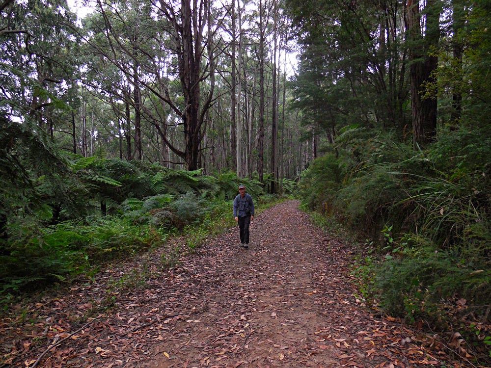
I started out walking west on Welch Track. Immediately, the track plunges into beautiful forest with huge eucalpyts and an under-storey of luxuriant tree ferns. The junction with Coles Track feels a bit like a slap in the face as you have to walk alongside an area of spaced trees as a subdivision backs onto the park here. The track climbs up to about 350 metres and heads away from surburbia and into wonderful forest again. Grants Picnic Ground comes upon you far too soon where I was surprised to find many buses, walkers, tourists and not surprised to find the obligatory cafe selling Metabolic Syndrome. 

 Tree ferns

Skedaddling out of this congested area as fast as possible I wandered down Hardy Gully Nature Walk past more thickets of tree ferns and towering mountain ash trees a few centuries old. Neuman Track climbs up to a ridge again passing a delightful little opening in the forest where a grassy meadow was catching shafts of sun. I heard the thrilling sound of at least a half dozen lyre birds along this stretch mimicking everything from bell birds to whip birds to kookaburras. Absolutely wonderful. The end of the walk was a downhill stroll along Paddy Road and the end of a walk that was about six hours too short. If you've never heard a lyre bird, click here to listen to this wondrous bird mimicking many other birds. 

Single tree fern thinking outside the box

The Big Problem: Big Food, Big Pharma, Big Athletics

Obviously - this is The Conspiracy Times after all - I am one of those folks that mistrusts big industry and believes in collusion. Big Pharma has convinced most of the world that cholesterol will kill us and statins will save us. BigFood has managed to get 90% of the First World population addicted to cheap, nutritionally barren processed food-like substances made almost entirely of corn and soy - which coincidentally frequently raise certain cholesterol components and almost always cause Metabolic Syndrome (the real cause of heart disease). 


The upcoming, and no doubt highly profitable new big business is Big Athletics (often represented by smaller companies but frequently subsidiaries of Big Food and Big Pharma) who are hooking the few remaining healthy First World adults not savvy enough to decipher the marketing jargon onto processed food-like substances in the form of gels, energy supplements, recovery drinks, work-out bars, etc. While these various and universally over-priced food-like substances almost always contain some minor trace elements such as zinc, magnesium, L-carnitine, among others, the staple ingredients in these food-like substances are invariably corn and soy. That's right corn and soy - those highly subsidised big agriculture crops that have ruined our food supply - converted, using the magic of big industry, into maltodextrin, glycerin, glycerol, sucrose, fructose, various sugar alcohols, and other highly palatable (I know it does not sound palatable but humans do find sugar in any form highly palatable, some even say addictive) food-like products. 


Big Athletics is doing just as good a job as Big Pharma and Big Food in creating demand for products - manufactured almost exclusively from the over-supply of corn and soy - that does not really exist. I perused a few Big Athletics products to produce this blog post (not too many, the web sites were universally nauseating) and discovered that there was a whole range of products that I should - according to Big Athletics - be consuming in order to fuel my regular fitness activities.


Let's take my physical activity today for example. I did a weight training workout for which I should have consumed, at a minimum, various bars, shakes and powders post workout to restock muscle glycogen and repair damaged muscle tissue (the whole purpose of weight training is damaging muscle tissue). But, that's not all I did today. I also walked about four hours which put me in the "over three hour" nutritional requirement category. [Shockingly enough I not only did a weight work-out but walked for two hours before I ate anything today] Apparently, along with taking a bunch of electrolytes, I should have consumed various sugary bars, gels, and powders. 


What I found most confronting was the requirement for all kinds of other sugary bars, gels, powders and drinks for exercise lasting under three hours. Really! This is quite a marketing coup. Big Athletics has somehow managed to convince people that they need all kinds of manufactured food-like substances to do under three hours of exercise! Frankly, if I couldn't do three hours of hard physical work without needing calories in any form, I'd be looking at training my metabolic system to burn body fat, not plugging it up with more sugar. 


Just like Big Food, Big Athletics loves to disguise sugar by using various chemical names (maltodextrin, xylitol, etc.) and/or by dividing the total sugar content using several different names for sugar (e.g. organic date paste/evaporated juice, etc.). It's not clear, however, that this classic subterfuge is even necessary as Big Athletics has been so successful at creating demand by convincing consumers that exercise is only possible when fuelled by glucose.  This is nonsense, just as cholesterol causing heart disease is nonsense. It is, however, pervasive nonsense and requires a healthy dose of skepticism and some diligent research to dispel. 

Currently, just as it is heretical to question the anti-fat lobby, it is heterodox to suggest that an athletes' first order of training should be to adapt their metabolism so they can fuel endurance activities with body fat instead of taxing their metabolic systems and setting up a cycle of chronic inflammation by ingesting copious quantities of sugar, in all its myriad forms.  

Athletes, do yourself a favour, do a modicum of research (not sponsored and/or promoted by Big Athletics), question everything, and ultimately realize that  Big Athletics = Big Food = Big Pharma = Big Problem.
 

30 kms, no powders, pills, gels, bars, goops or even food.

Thursday, January 29, 2015

It Does Not Have To Suck

It's probably fair to say that skiing in Western Canada right now is pretty bad. Temperatures that are too warm (15C has been reported), precipitation that is too scanty, and Pineapple Express systems that are too frequent. It's hard to know exactly how bad it is because most people seem to mountain biking or climbing at indoor gyms, not skiing, but, maybe that says all that needs to be said. 


This chart of Whistler historical snowfalls popped up on my Crackbook feed a few days ago with the comment "be glad we're not back in 04/05" which was all the impetus I needed to see what exactly Doug and I got up during the winter of 2004/2005. Specifically, I wondered if bad snow necessarily means a bad ski season. 


I didn't tally up my actual ski days for 2004/2005 but I did discover that we climbed 39 different peaks, did two ski traverses, and went on four hut trips. Certainly these broad brush strokes don't imply a bad season. Looking closer at the data, we certainly had less than ideal conditions on many days. Various rain events, wind and warmth events are mentioned, there seems to have been lots of crusts and much wet snow, but there was also many sunny days with safe and fast travel conditions that we obviously made the most of. I can actually remember this year fairly well as we did many long ski trips and traverses going up and down many peaks and into many valleys that I had never visited before. 


Zig Ziglar said "Your attitude, not your aptitude, will determine your altitude" and that certainly seems to have been the case for us in the winter of 2004/2005. Enough said. 


Monday, January 26, 2015

Bald Hill - Luptons View Loop, Bunyip State Park

I went back to Bunyip State Park today for another loop walk. This isn't amazing walking terrain with sweeping vistas and interesting tracks, but, there is plenty of opportunity for solitude (the roads/tracks are all gated so only the self or horse-propelled can access them, which automatically rules out almost 99% of the population), the forest is beautiful and it is very close to where we are house-sitting. 

This time I did a loop (about 13 km/400 m gain) on the south side of Tonimbuk Road (one of the major east-west roads through the park) and saw no-one for the almost three hours I was out except for a family group of three on horses - it's surprisingly easy to walk as fast as horses. 

I parked at Mortimer Picnic Area again which seems like a good place to leave a car off the road (noted the half-empty soft-drink cans I would take home to dispose of, cursed "sugar burners"), and wandered off to the south along the Yarra Bubba Track. At a saddle, I intersected the Sandpit Ridge track which took me along a couple of low ridges to the park boundary at Pooley Road. I did have to suck up almost a kilometre of road walking (gravel and quiet) to complete this loop, but, at the junction with Tynon North Road I got off on Avards Track which ambles up a spur ridge to 300 metres and a junction with Lupton Track. Along Lupton Track heading west there is a viewpoint looking north over Diamond Creek valley before the track descends to cross Tynon North Road again. A short stretch on Cannibal Creek Track leads to Dawson Track and a nice forested walk out to the Tonimbuk Road. Although not shown on the Victoria Parks map, a track leads back to Mortimer Picnic area so you don't have to close this last section of the loop on the road. 

 Luptons View

Saturday, January 24, 2015

Four Brothers But No Bunyips

We are staying near Emerald for a couple of weeks, in a house (so nice to be in a house for a while) that happens to have a killer staircase for bouldering, as well as a plethora of parks in the immediate area where you can go walking. 

Never climb stairs the regular way again
I found some details about a loop walk from Mortimer Picnic Ground in Bunyip State Park which led up to Four Brothers Rocks. The Victoria Parks brochure describes the view from Four Brothers Rocks as "sweeping." I wouldn't actually go that far, but Four Brothers Rocks does make a convenient location to get to on a walk which is otherwise a desultory meander through the woods. 
Our loop was about 12 km with about 500 metres of total elevation gain (both guesses). There are a lot of old roads in Bunyip State Park but luckily most of them are gated and accessible only to walkers, cyclists or horse-riders which means they are quiet and peaceful. The forest is very pretty with lots of big old eucalpyts and many tree ferns. Leeches must be bad during winter as, despite only about a millimetre of rain having fallen overnight, I saw a lot of the buggers looking for blood on the Tree Fern track.

Starting out on Triangle Track
Anyway, from Mortimer Picnic Area, we strolled north on the Triangle Track to Windy Point Track (both gated so not accessible to bogans) which we followed (also north) to Tree Fern Track. The first section of Tree Fern Track seems to have been hastily hacked out of the surrounding tree fern forest but, after you cross Link Road, the track seems wider and better built and it is a pleasant stroll through stands of tree ferns to Nichols Hut Track. We never saw a hut, so I have no idea what the name of this track references but it climbs about 300 metres up a spur ridge to join Burgess Track (beyond the vehicle gate). It's about 1 km round-trip southeast along Burgess Track to detour to Four Brothers Rocks and a somewhat narrow view north across Black Snake Creek valley to Yarra State Forest. 
We followed Nichols Hut track back down hill to Link Road where a new bit of track not shown on the Victoria Parks map connects with Ferres Track and Silvertop Ridge track thus avoiding any road walking. Ferres Track is shown on the Parks map as following a Diamond Creek but it actually seemed to climb up and over a ridge line before wandering back down to join Triangle Track near Mortimer Picnic Area. 

 Four Brothers Boulders