Over 20 years ago, Doug
and I did a nine day sea kayak trip around the Whitsundays using our
Feathercraft double “folding” kayak. We were both between jobs –
a delightful six month hiatus during which we kayaked around the
Solomon Islands, through Marlborough Sound in New Zealand, as well as
whitewater paddling on rivers in southern NSW. All these years later
I can only remember strange and seemingly unrelated details about our
Whitsunday trip. I know we were hungry. We had no transport and all
the groceries we brought on the trip had been arduously carried on my
back from the grocery store some few kilometres distant under a
baking tropical sun. Shocked by how full my back pack was getting, I
just, at some random point, stopped. It turned out that I stopped a
wee bit too soon. Aggressive white tailed rats (a native rat) chewed
everything at the camp at Whitehaven Beach and we were so afraid they
would chew a hole in the fabric skin of our kayak that we anchored it
off-shore (the only time we have ever done this) overnight. And,
finally, on one amazing day, we shot through Solway Passage on the
incoming tide and, riding tides and wind, raced back towards Airlie
Beach on one of the most effortless days of paddling I had ever had.

Doug heading north a tiny island paradise
Here we were again,
launching from Airlie Beach, but, instead of heading east to the main
Whitsunday Islands, we were heading north, along the shores of
Dryander National Park to Gloucester Islands National Park, a group
of island rumoured to be quieter and less busy than the bustling main
islands of the Whitsunday Group. As usual, we were amazed at just
how much gear can be stowed away inside a sea kayak and, in light
winds we paddled north with our kayak sails listlessly catching the
minor breeze as we ambled north passing narrow headlands, deep bays,
and scaring turtles as they surfaced in the aquamarine water.
Our first nights camp was
on the northern side of a long spit of land (Grimstone Point)
sheltered under large shady fig trees behind a sandy beach. The
tides in the Whitsundays are some of the largest on the east coast of
Australia so we were timing our departures as much as possible to
catch favourable tides. Mornings, instead of rushing out on the
water early, were spent bouldering on the granite boulders and slabs
of the rocky shorelines or wandering along the beach.
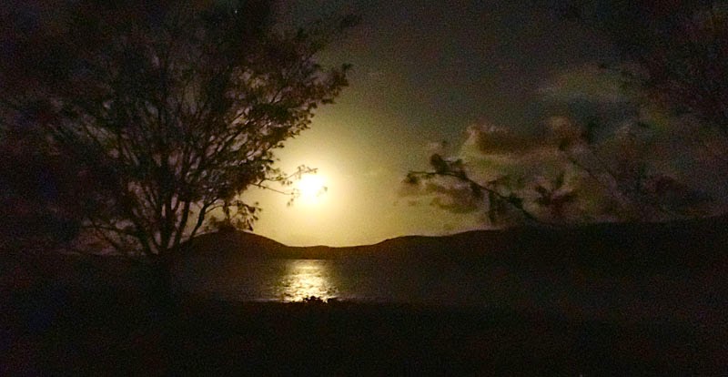
Moon rise, Saddleback Island
Our second day was one of
those wonderful paddling days that unfold seamlessly. With the
ebbing tide, we paddled north to Grassy Island, where we stopped on
an exposed rubble coral beach to stretch our legs. The winds, which
normally blow at around 20 knots from the southeast at this time of
year (the trade winds) were light, so even south facing beaches were
benign. From Grassy Island, we passed tiny Edwin Rock and landed on
a steep sand beach on the west side of Olden Island for lunch.
Swimming off the beach was wonderful and turtles dandled by as we had
lunch. The east facing cliffs leading to George Point offered some
bumpy water and the current was running around George Point but
nothing very intimidating. Rounding George Point, Saddleback Island
cut a distinctive silhouette against the tropical sky.
The campsite on Saddleback
Island is on the western end of a large sandspit. On the eastern
side, a rocky reef dries at low tide and provides interesting
foraging. That night, as we sat having dinner under a daylight
bright full moon, I began to think that perhaps, with the benign
weather we were having (our second day of light winds with three more
forecast), we should have been out on a "bigger" trip.
Back in Cairns, I had planned out a series of different trips around
the Whitsunday and Cumberland Islands and, we had chosen to start
with this modest trip, because, after the long wet season in Cairns
we did not feel in great paddling shape for long (30 km) crossings
and rough water. Such is the nature of adventure, or perhaps
adventurers, even while you are on one trip, you begin to dream of
the next.

Sunset on Gloucester Island
From Saddleback Island, we
meandered past Manta Ray Island arriving at Gloucester Passage around
slack tide and paddled easily across to the southwestern shore of
Gloucester Island where we found a deluxe campsite under a huge
spreading many trunked fig tree. Along the beach, a freshwater
stream ran out into the shallow bay and, walking up the rocky creek
under massive paperbarks we washed off the days salt each evening in
the cool, clean water.
Gloucester Island runs
north-south for 10 km and has a rugged spine of 500 metre peaks
jostling up the centre of the island. The western side with
sheltered sandy bays and rocky beaches is popular with power boaters.
The eastern side features steep red rock cliffs, deep sea caves and
only a few scattered rubble strewn bays mostly exposed to the
easterly swell. On another day with light winds, we circumnavigated
the island paddling in close to the red rock cliffs, nosing into
caves, and landing on the steep rocky beaches. Paddling into the
only campsite on this side of the island, East Side Bay, we were
jostled by standing waves where the orientation of the island changed
from north to west. In stronger winds, this would be a much more
treacherous stretch of coastline.

Early morning
We paddled into Bowen via
Middle Island, a day which required an early start, and we were on
the water before dawn, and, kayak sailing with a beam wind, we were
just able to crane around and watch the sun rise in a spectacular
flame of colours over Gloucester Island. The wind helped and we made
good time covering the 9 kilometres to Stone Island from Middle
Island in about 1.5 hours. Again we were just around slack tide
paddling into North Entrance past the disused lighthouse on North
Rock and suddenly, after a week out on the water, we were back again
among people in a town.
No comments:
Post a Comment