Shute Harbour to Dugong Beach:
In order to catch slack tide at the
south end of South Molle Island, we had planned to start paddling
from Shute Harbour at 9 am. Not only would we round Roma Point at
slack tide, but we would cross Whitsunday Passage when the wind and
tide were congruent. But, when you wake at 5 am and are anxious to
start your trip, there seems little point wasting time so, on the
first morning of our seven day trip around Hook Island, we were on
the water before 8 am and paddling east out of the narrow channel
between the mainland and the cluster of three islands (Repair,
Tancred and Shute) in Shute Harbour. Dark rain clouds were massing
over Whitsunday Island, rain squalls moved up from the south and a
gusty south wind was blowing.
We had recently heard from a friend
that the passage between Mid and North Molle Islands marked "unsafe
passage" on the nautical chart is, in fact, the main
thoroughfare through the Molle Islands and the route of choice for
kayakers heading east. This passage was our fall-back position
should the waters off South Molle Island, marked by whirlpools and
standing waves on our chart, prove too rough. I hoped to paddle the
south route as we would be returning via the north route and Doug
hoped to paddle the south route as he thought it was shorter than
going to Dugong Bay via the north route. We decided to paddle out
and have a look. Should conditions prove too difficult or dangerous,
we would paddle north up South Molle Island and use "unsafe
passage."

Doug in unsafe passage
Visibility from a kayak is never great.
As the kayak sinks into a wave trough, the view ahead all but
disappears, and, even on a wave crest, you can only see a short
distance from where you sit at absolute sea level. We could see
white-caps and standing waves as we approached Roma Point, but they
didn't look too bad and we thought we would simply give the point a
wide berth. However, as we approached the point a large squall with
heavier rain and obscured visibility moved over us. I suggested to
Doug that we paddle into the beach (Sandy Bay) at the south end of
South Molle Island and let the squall pass over as I did not want to
be out in the middle of Whitsunday Passage during a period of poor
visibility. Not only would we lose our landmarks, but we would be
almost invisible to passing boat traffic.
This is when the trouble began as we
soon discovered we were stuck in a tidal rip that runs at 3 to 4
knots. With our full metre square sails up, a south wind, and
paddling as hard as we could, we simply could not escape the tidal
rip that was pulling us inexorably towards the haystacks and standing
waves off Roma Point. We could only communicate by shouting at each
other, nuanced decision making was impossible, and, at some point, we
decided to ferry glide west towards Beak Point. After 1.5 hours of
tough paddling, we finally pulled into the calm waters between Coral
Point and The Beak to regroup.
While we had the cold breakfast I had
packed we discussed our options. Clearly, paddling south of South
Molle was out of the question and, we weren't even sure we would get
across Molle Channel anywhere, but, I managed to convince Doug that
we were now near slack tide, and could hug the coast line heading
north where the current would be reduced by friction with the land,
and ferry glide or even catch the current south to Daydream Island
and then onto Mid Molle Island. Paddling around The Beak, Daydream
Island looked so close and the paddling was so easy that we decided
to head straight over to the south end of Daydream Island. We
crossed easily, some minor standing waves, riffles really, at the
south end of Daydream were all we encountered. There was some minor
current riffles between Daydream and South Molle, but we crossed
easily to the east, passed over The Causeway between Mid and South
Molle Islands (easily passable in a kayak with a 3.00 metre tide) and
pulled into Paddle Beach on the north end of South Molle Island for
Doug to adjust his sail.

Doug crossing Molle Channel
Although we had started an hour ahead
of schedule, we were now an hour behind, and were mildly concerned
that we would arrive at Dugong Beach on the west side of Whitsunday
Island at low tide and thus be unable to access the camp-site. But,
we were anxious to continue, the wind was gradually easing and the
squalls clearing so we began the nine kilometre paddle over to Cid
Island at around 11 am. The first two kilometres past Deedes Point
took a long time as the kayaks see-sawed up and down in the metre
swell, but, gradually, we caught some wind in our sails and we began
to pull further and further from South Molle Island. A couple of
kilometres out from Cid Island, the waves eased, but the tide and
wind were both carrying us north so it was still hard work to pull
into the lee of Cid Island where we regrouped. Dugong Beach was off
to our northeast, Whitsunday Peak making a good marker for where the
camp was located, as we tiredly paddled the last few kilometres to
camp.
Dugong Beach has two covered picnic
tables as well as several other open tables, seven separate camping
sites and a track that leads over the headland to the south to
Sawmill Bay and the start of the track to Whitsunday Peak. We had a
late lunch and mug of coffee and then, as the day was rapidly waning,
sprinted along the track to Sawmill Bay and up to Whitsunday Peak to
catch the view of the islands before dusk. On the way back, we swam
in a pool in the freshwater creek and arrived back at camp near
sundown.
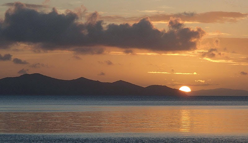
Dugong Beach sunset
Dugong Beach to Crayfish Beach:
Next morning, we could feel the
previous days exertions, but, the forecast was for light winds and
favourable conditions for paddling the exposed east side of Hook
Island. We left camp sometime after 8 am and, in dead calm
conditions paddled 12 km north along the west side of Whitsunday
Island to Cairn Beach at the northern tip. The boats, loaded with
seven days food and water, were heavy and sluggish to paddle and it
was hot work under the clear sky. At Cairn Beach we were tempted to
hike up the track to Whitsunday Cairn, but we still had ten
kilometres to go to camp and the calm winds tempted us to paddle
north while conditions were so benign.

Sailing up the east side of Hook Island
We caught the current out through the
narrow channel between Hook and Whitsunday Islands and paddled
steadily north. There were standing waves off the point south of
Mackerel Bay and large sandstone cliffs eroded into deep caves as you
paddle west towards Crayfish Beach. Crayfish Beach is a beautiful
spot tucked into a sheltered bay at the south end of the larger
Mackerel Bay. The shallow sheltered waters of the bay are full of
coral, and the tiny beach with a few grassy campsites is one of the
most beautiful on Hook Island. After another late lunch, we launched
the boats again and paddled over to the west side of the bay where we
tucked the kayaks into a rocky cove and snorkelled until the tide
threatened to strand the boats over coral gardens, among coral caves
and grottos, where tropical fish flickered in the light, reef sharks
prowled the short coral walls and turtles were startled from reverie
into deeper waters.
Crayfish Beach to Steens Beach:
On our third day, we were up again
before dawn, and, in the last moments of night, launched the kayaks
and glided silently north towards Pinnacle Point and the north end of
Hook Island. On shore, the rocks and hoop pines were painted red and
gold by the rising sun. At Pinnacle Point, we wove in between the
mainland and the rocky islets that give the point its name, and
gradually turned west towards Hayman Island. The tide was flooding
south and the entire north side of Hook Island was mildly bouncy as
the incoming tide ran against the north side of Hook Island.
There
were lots of day tour boats in Butterfly Bay, all ignoring the
passage of two mangy looking kayakers. We arrived at Steens Beach, a
narrow stretch of sand backed by rock boulders and rainforest at 9.15
am and happily pulled ashore for breakfast. All along the northern
coast of Hook Island the shallow clear waters support beautiful coral
reefs and as we paddled west we would catch glimpses of tropical fish
flashing in the sunlight. After a couple of long days in the boat, I
spent a happy few hours wandering south along rock shelves and pebbly
beaches before returning to camp to snorkel over the reef off Stanley
Point. All too soon the sun was dropping over the western islands
and another day was over.

Sunset at Steens Beach
Hayman Island:
We had a "lay day" at Steens
Beach, which doesn't mean laying about, but does mean a break from
the daily packing and unpacking ritual and a chance to explore the
surrounding area. Leaving camp at a leisurely 9 am, Doug hugged the
shore heading south, while I paddled over the edge of the reef south
of Stanley Point. At Cockatoo Point we crossed over to Black Island,
a tiny sandy island amid an expansive reef and snorkelled along the
reef edge among turtles, fish, sharks and rays. A number of tour
boats had pulled up to allow the guests to snorkel on the western
shore.
To the west of Black Island, three
other small sandy islets are connected by coral reef, and we paddled
past Bird, One Foot and Langford Islands and then north across Hayman
Channel to pass over the reef between Arkhurst Island and Hayman
Island.
On the west side of Hayman Island, we
paddled into Blue Pearl Bay and found an old picnic bench under a
spreading fig tree for lunch. A bit of searching along the
shore-line revealed the track that leads up to Whitsunday Lookout on
Hayman Island. We had a fantastic view down the length of the
Whitsunday Group to the Cumberland Islands, the blue waters
shimmering in the sun. At the north end of Blue Pearl Bay large
coral bomboras rise out of the deep water. Tour operators come here
and feed the fish so hundreds of tame reef fish drift around you in
multi-coloured waves as you swim over the reef.

Dolphin Point, Hayman Island
Continuing north around Hayman Island,
we paddled over coral gardens, past large sandstone cliffs and
turrets, past Dolphin, Tower and Rescue Points and eventually down
the east side of the island. The coral reef extends right around the
island and every so often we could catch the bright flash of a
multi-hued wrasse. We crossed the narrow channel back to Steens
Beach as the last of the tour boats steamed east towards Airlie
Beach.
Steens Beach to Curlew Beach:
Paddling north in the Whitsunday
Islands you know that eventually, unless you keep going, you must at
some point paddle back into the wind. Our fifth day started with 20
knot southerly winds but the forecast indicated they would decrease
during the day. We took our time packing up, and, while Doug read
his book under the shade of the casuarina trees I went snorkelling
one last time along the shallow reef off Steens Beach. I knew this
would be my last snorkel of the trip, and possibly my last for a long
while, and I especially enjoyed drifting aimlessly along admiring the
beauty of the reef.
We had a 19 km paddle south and east to
Curlew Beach at the opening of Macona Inlet on the south end of Hook
Island and calculated we needed to leave no later than around noon to
arrive before dark. At 11.00 am, the wind seemed to be dropping, so
we loaded the boats and began paddling a half hour later. There used
to be an old National Park camping area at Bloodhorn Beach between
Baird Point and Ian Point and we pulled in to see if any sign of it
remained. There is a flat area under the trees where camping is
possible, but the beach is quite rocky.

Hoop Pines, aquamarine water, sandstone bluffs
It felt slow paddling to the south end
of Hook Island, we were now paddling against wind and tide, but, the
coral reef and rocky shore-line provided interest. At the south end
of Hook, we tucked into a tiny bay within a bay formed by a large
rocky promontory and had a short rest. There were large standing
waves off the point west of Nara Inlet which provided a minute or two
of exciting paddling. Finally, we rounded the last point before
Curlew Beach where big hoop pines stand out on the craggy point and
pulled into the sandy beach and camping area sheltered under fig
trees.
Curlew Beach to Paddle Bay:
On our penultimate day, we had 15 knot
southeast to southwest winds and left Curlew Beach before 9 am. The
day's paddle was relatively short at 15 km, but we had a 13 km
crossing of Whitsunday Passage. This was an unusual crossing.
Initially, the sails seemed to be lifting the boat and speeding us
up, other times, my boat felt heavy and sluggish, and seemed to crawl
forward. An hour into the trip, I reefed my sail in as I was having
trouble managing the full metre square in the burly cross-wind. We
had the ebbing tide in our favour, but the northerly push we had from
the wind was probably counterbalancing any southerly assistance. The
final few kilometres into the small beach on Mid Molle Island seemed
to take an inordinately long time, especially as my bladder had long
since reached capacity. I had a comfort stop on the beach, but Doug
stayed in his boat, and we paddled the last 1.5 km into the wind to
the open campsite at Paddle Bay on South Molle Island.

Kayaks in Blue Pearl Bay
There is a now defunct resort in Bauer
Bay on the north side of the island and an intersecting series of
trails. After lunch, we hiked up Lamont Hill - the view is largely
concealed by the surrounding forest, and then south to Mount
Jeffreys, a windswept grassy summit with wonderful views of the
island chain. Finally, we walked on an open grassy trail with
expansive scenery to another lookout near The Horn on the
northeastern end of the island. We walked back to our camp through
the resort and along the rocky shoreline. That night the sunset
blazed in a glory of colours for an hour before finally dimming into
night.
Paddle Bay to Shute Harbour:
The last day was very short, around two
hours to paddle the seven kilometres west to the south end of
Daydream Island and then south past The Beak and into Shute Harbour.
The wind was blowing at 15 knots, but these waters are mostly
protected so waves were small. I felt sad our trip was over,
privileged to have travelled in such favourable conditions, and once
again, stunned by the amazing sea kayaking available in northern
Queensland.

The last sunset
No comments:
Post a Comment