There’s a Spring Creek Fire Trail (FT) but no creek named “Spring Creek” on either the standard topographic map or Six Maps NSW, but, it’s easy enough to work out which creek the FT is named for as the FT crosses the upper reaches of the creek a number of times. Spring Creek runs into Nelligen Creek which runs into the Clyde River. I’ve been along Spring Creek FT before when I was doing a lot of trail running. That time, I followed Spring Creek FT all the way down to where it crosses Cabbage Tree Creek in Monga National Park. It’s a hilly FT and fairly eroded and somewhat slippery after heavy rain followed by lots of dry weather. I’ve also been down along the banks of Nelligen Creek on a couple of occasions most notably when I trashed all my clothes trying to bushwack up Erics Ridge.

Why would I be back in this area when I had all but sworn off bushwacking until the fire regrowth dies out? Well, I had seen some recent photos online of a group walking along Spring Creek and the trip looked quite reasonable and reasonably interesting. A short drive for me, a FT approach, and some rocks to scramble over.

Here’s the thing, I went down the eastern tributary of Spring Creek and I believe now that the images are from the western tributary of Spring Creek. I had planned, or at least thought about, descending the eastern tributary and following this roughly SW to where both branches of Spring Creek join and then regaining the FT by following the western tributary roughly north.

The eastern tributary had a small amount of water in it and is the first crossing of Spring Creek you reach as you walk along Spring Creek FT. Following the creek was reasonably easy and reasonably pleasant. In places it was easy to walk along granite slabs in the creek – the water level is really low right now-, although the water-washed slabs were surprisingly slippery. Some places, however, were choked with large piles of flood debris indicating that even this little creek has significant flow at times. It was, however, quite easy to follow game trails along the left hand (eastern) bank when required.
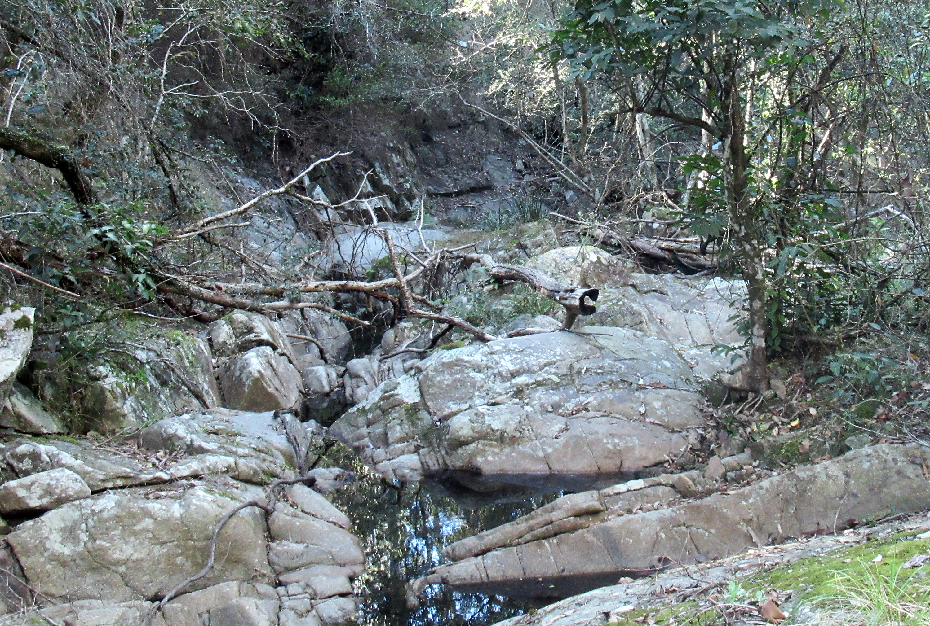
After a while, I came upon a large grassy flat area near the creek, a good spot to pitch a tent, and the confluence with the western tributary. I followed the western tributary north for a while but the bush in this smaller drainage was very thick, and the going not pleasant at all. Looking at Google Earth more closely, I think the big slabs in the images are in the upper reaches of this western tributary not down near the confluence. As I had already passed a number of large and healthy Stinging trees on the more open eastern tributary I was not keen to potentially encounter more of them in the thick bush of the western tributary; and, of course, there is only so much thick bushwacking I have patience for.

No comments:
Post a Comment