You guessed it, more rain in Cairns, so time for another stroll down the pathway of my memories. Looking for inspiration, I clicked open our trip database (having a programmer for a partner can be pretty handy) and used the handy "this day in history" feature - a tribute to our good friend now sadly missed, Kim Kratky - to find this old trip report from 2009.
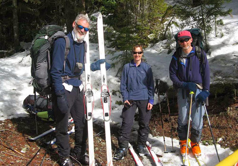
Robin, Betsy and Doug at the end of our trip
Prologue: In late February/early
March, we’d kicked around a few ideas for a short ski traverse for
mid-March with Captain Bivouac and Betsy Waddington, but, we seemed
unable to settle on a destination we could all agree upon. Captain
Bivouac, romantic as always when it comes to the Rockies, was
convinced that a great Rockies traverse travelling many kilometers
each day up untrodden valleys to lost passes on long skinny skis with
leather boots and cable bindings would be the best trip imaginable;
but Doug and I, altogether more realistic about conditions vetoed
this plan as we knew from friends in the Rubblies, that this years’
(2009) snowpack was significantly worse than last years, and, in most
places was failing to support even a light weight skier.
Eventually, the idea of a trip through
Manning Park surfaced, and two days later, Doug and I were driving
west to meet Robin and Betsy at Cambie Creek packed for a 5 to 6 day
trip with a rough itinerary we could shift around to suit conditions.

Three Brothers Mountain from the south
Day 1, Cambie Creek to Big Buck
Mountain: The first day out with a big pack is
always a bit of a grunt, and it seemed a bit of a trudge up Cambie
Creek and Fat Dog trail to the sub-alpine area around Big Buck
Mountain. Of course, the trail was just a bit worse than previous as
immediately before we left, a group of six snowshoers and one
postholer had marched off up the trail ahead of us, stomping the ski
track into a rutted mess.
Once we got to the subalpine ridges
near Big Buck Mountain, we finally passed the snowshoers, and emerged
into the full brunt of a strong SW wind. Wandering up towards Big
Buck we had lots of whumpfs and there were numerous recent slab
avalanches, evidence that the snowpack was just a bit worse than
before. We ended up setting up camp early in a sheltered area about
a kilometre from Big Buck Mountain as we weren’t sure where the
next protected area would be. Unfortunately, a gang of five sled
hooligans were roaring around the sub-alpine, well inside the park
boundary on their sleds. At one point they drove right past our camp
and all the way over to the Heather Trail. For all we know, they
sledded right down to the Ranger Station.

Big Buck Mountain
It was at this point that Doug and I
discovered that I had forgotten to pack the pole for our tent
vestibule and had brought half the amount of white gas I should have.
I left Doug trying to jury rig the vestibule and skied the kilometre
or so to the top of Big Buck Mountain where the wind was almost
strong enough to blow me to Princeton.
Day 2, Big Buck Mountain to Nicomen
Ridge: Our makeshift vestibule using two ski
poles actually worked better during the night than the proper version
with the aluminium tent pole, but when we tried to pack the tent in
the morning it was like trying to wrestle with a hungry alligator.
This is our second single wall Integral Designs tent – the first,
lasted 15 years, never leaked, got wet with condensation or
threatened to collapse in a storm. But, the newer version –
advertised as “breathable”, breathes about as well as a fish out
of water, and, despite sleeping with the door open all night, the
walls were caked in frozen condensation, thick enough to generate a
Rockies ice climb in good plastic conditions.
While we bemoaned our misfortune to
have purchased such a dud, Robin related his recent shopping
expedition to MEC looking for a replacement summer tent. It seemed
he had inadvertently sent the salesperson into an apoplectic fit when
he described his ideal tent as one “tall enough so I can sit up in
one end while Betsy cooks in the other”. This sent the salesperson
into paroxysms of proclamations of certain death due to grizzly bear
attack. Once the salesperson had recovered the power of coherent
speech, it became evident that MEC had a good selection of tents, but
none quite as good as the one Robin was trying to replace.

Betsy skiing up Fourth Brother Mountain
The wind was somewhat less than the day
before, and it was snowing only very lightly as we skied past Three
Brothers Mountain on the southwest side, through a narrow pass and on
through gentle sub-alpine terrain to the west side of Fourth Brother
Mountain. Here we dropped our packs and skinned a short distance up
to the top of Fourth Brother Mountain, where, true to stereotypes we
found the small area just below the summit littered with beer cans
dropped by the sledheads.
We had lunch back at our packs, and
then carried on skiing generally northwest staying right on the ridge
top where the terrain is broad and easy all the way to Nicomen Ridge.
We followed Nicomen Ridge east for about 300 metres until a spur
ridge runs north. This was the crux of this very easy ski trip, a
short section where you must stay right on the ridge to avoid
avalanche exposure. We skied easily down the north spur ridge and
found a sheltered area to camp just before the ridge begins to climb
gently to the north again.

Betsy above Nicomen Lake
Day 3, Nicomen Ridge to Hope Pass: It was snowing again in the morning and
the weather was just a bit worse than it had been the day before. We
were lucky this section of the trip was in the trees as any time we
came into a larger opening we would feel the brunt of the wind
driving the snow along. From our campsite we climbed gently to the
summit of a north south running treed ridge, then descended about 140
metres down to a pass, before climbing again, this time heading
northeast to reach a broad flat ridge system that led us east to
another large flat summit.
Lunch was a cold affair, spent huddled
under some trees while the snow fell and the wind blew. After lunch,
we continued north passing by some small tarns, and then eventually
descending to Hope Pass, a narrow cleft between two treed ridge
lines. At Hope Pass, it was snowing heavily and blowing, so we
followed a compass bearing west to a small tarn that offered
sheltered camping in the trees.

Our tent now free standing
Day 4 Hope Pass to Grainger Creek: By now, Doug and I were thoroughly wet
inside our “waterproof, breathable tent” and approached our third
night in this frigid version of a sauna with some trepidation. I
slept in every piece of clothing I’d brought with me, including a
down jacket, and managed to stay warm, but woke with the ice on the
walls a full centimeter thick by now.
There was a fresh 20 cm of snow on the
tents in the morning, but luckily it felt pretty light. Although it
was still snowing, we headed off to ski to the top of Skaist
Mountain, following the inevitable compass bearing to the northeast.
The top is fairly open, and might have had decent views but all we
saw was snow and a hint of a ridge line in the distance.
Back at camp we wrestled the tent away
and headed off skiing slightly downhill and heading west. The trees
were tight and some of the terrain a bit tricky to ski through.
However, the fresh snow made the descent a fair bit more pleasant
than skiing on breakable suncrust. Robin was having a terrible time
with his gaitors, which, for some inexplicable reason had been made
with Velcro closures – who exactly thinks Velcro will work in snow?
– and they kept popping open and forming the shape of a inverted
snowplow which funneled large quantities of snow into his boots at
every turn. Clearly, these gaitors were much worse than the pair he
had before.

Easy skiing along the route
After we’d been descending and
traversing for perhaps an hour, Doug stumbled onto the Hope Pass
trail and for a while, we cruised downhill following it through
switchbacks and down near to the Skaist River. Near the river, we
lost the trail and also lost quite a bit of time trying to find it
again. Eventually we did, and skied on for perhaps half a kilometre
before repeating the whole process again. After doing this about
three times, we decided to just head in the direction we knew the
trail was going and hope to pick it up. After this, we never lost it
for more than a few hundred metres, and always found ourselves back
on it again in short order.
The lower we got the heavier the
trailbreaking got, and occasionally, the snow would stop falling and
the sun would pop out. In these brief interludes the snow quickly
became wet, sticky and heavy. We plugged away reaching a bridge
across the Skaist River around 3 pm where we stopped during a brief
sunny spell for a snack.

Robin tunneling into a snowbank
Once across the bridge we lost the
trail and wandered a bit on a small island in the river, which we
eventually had to get off. I stood midway and watched Betsy doing
some creek skiing to exit on my right and Robin doing some snow- tunneling to exit on my left. Unexpectedly, given the hilarity
which watching Robin had provided, his exit seemed easiest and I
cruised up that way. Continuing downstream we hit an impassable
canyon and had to skin up a steep side-hill perhaps 80 metres or so
where we suddenly came upon the trail again. It was near 5 pm by the time we reached
Grainger Creek camp and we were all feeling tired. Our tent now had
a glaciers’ worth of ice on the walls and we were actually able to
erect it without using the poles at all.
Day 5, Grainger Creek to Cayuse Flats: Next morning we got away before 9 am
but spent the first 20 minutes searching for the trail on the south
side of Grainger Creek. Eventually, Betsy found it and we started
the day by skiing uphill for 15 minutes on a trail that was supposed
to be following the creek down.

Doug enjoying the skiing
The trail certainly provided some
entertaining skiing – the very occasional wide downhill section
interspersed with a mixture of narrow, lumpy trail with numerous
running cross creeks, severe uphill sections, downed trees that
required clambering over, half-downed trees best passed by doing the
limbo with a full pack, and various other impediments to smooth
travel. After the initial 15 minute climb, we managed most of the
way without skins, but, right at the end, the trail headed straight
uphill again, and all of us but Robin, put our skins back on and
somehow finished the trip going uphill again.
Epilogue: The moral of life, as we saw it on this
trip, is that every piece of outdoor gear you get will be almost as
good as the piece it is replacing. Think about it – you are
probably, like us, using pots that your grandfather made in shop
class and are now 50 years old because the new ones burn instantly,
your latest tent leaks just a bit more than the last one, your
gaitors won’t stay on/closed/fit over your plastic ski boots, the
pump for your new stove broke within the first six months of use, and
the replacement pump- which cost half as much as the stove - requires
a whole shop of tools to get it apart to lubricate the flange, your
skins don’t stick as well as they did, or that goofy G3 tail
attachment always blows off the end of your ski, and so it goes. The
best you can hope for, is to end up just a little bit worse off than
when you
started.

Three Brothers Mountain
Ha, ha! Just re-read Robin's TR on Bivouac then found yours. Heading up to Hope Pass tomorrow with the old retriever.
ReplyDelete